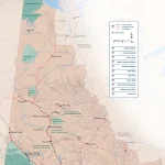
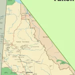
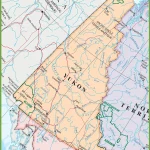
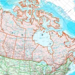
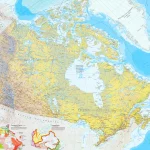
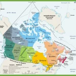
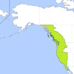
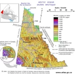
The Yukon

Home » The Yukon

Where is the Yukon?

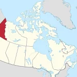
Nestled in the northern reaches of Canada, the Yukon is a vast and captivating territory that boasts an awe-inspiring landscape. Spread across approximately 482,443 square kilometers, it is larger than many countries! Located in Northwest Canada, the Yukon shares its borders with Alaska to the west, British Columbia to the south, and the Beaufort Sea to the north.

Home » The Yukon

The Yukon Highway Map: Navigating the Northern Wilderness

This map shows highways in the Yukon.

This detailed map provides a comprehensive view of the Yukon’s highways, main roads, secondary roads, and key natural features such as rivers, lakes, and national parks. With its user-friendly layout and easy-to-read design, the Yukon Highway Map is indispensable for anyone planning a road trip or exploring the territory’s many outdoor adventures.

Home » The Yukon

Discover Canada’s Cities and Towns with Canada Maps

Map of Canada with cities

This map shows Canada’s provinces, territories, cities, towns, and roads.

Home » The Yukon

Discover Canada’s Landscapes and Transportation Networks with Canada Maps

This map shows Canada's provinces, territories, provincial and territorial capitals, cities, towns, highways, roads, trans-Canada highways, railways, and rivers.

This map shows Canada’s provinces, territories, provincial and territorial capitals, cities, towns, highways, roads, trans-Canada highways, railways, and rivers.

Home » The Yukon

Discover Canada’s Governmental Boundaries with Canada Maps

This map shows the governmental boundaries of countries, provinces, territories, and provincial and territorial capitals in Canada.

Home » The Yukon

Exploring Pacific Standard Time (PST) in Canada: A Guide for Travelers and Locals Alike

Pacific Standard Time Zone Map

Pacific Standard Time (PST) is a time zone used in the western part of North America, including the western provinces of Canada and some U.S. states. It is eight hours behind Coordinated Universal Time (UTC-8) and three hours behind Eastern Standard Time (EST). PST is used to standardize time within a given region and is regulated by the federal government in Canada. Travelers and tourists need to understand PST, as it can affect flight schedules, hotel check-in times, and other aspects of travel planning.

Home » The Yukon

Yukon Relief Map – Explore Canada with ease using our printable maps!

The Yukon Relief Map

This map of Yukon provides a visual representation of the region’s diverse topography using hypsometric tints and spot elevations. It also shows significant lakes that are prominent in the region, which helps identify bodies of water in the area. The elevation data used in this map was derived from the highly acclaimed map Canada-Relief, Fifth Edition, National Atlas of Canada, published in 1986.

Home » The Yukon

Kluane National Park and Reserve

Kluane National Park and Reserve is a natural wonder located in the southwest corner of the Yukon Territory, 150 kilometers / 93,2 miles west of Whitehorse. Established in 1976, this 21,980 km2 park is a destination for adventure seekers, nature enthusiasts, and history buffs alike. With unclimbed peaks, vast ice fields, clear lakes, glaciers, and … Read more