national parks

Home » national parks

Trans-Canada Highway: The World’s Longest National Highway

Stretching from Victoria, British Columbia, to St. John’s, Newfoundland and Labrador, Trans-Canada Highway is a marvel of modern engineering and a testament to Canada’s vastness. The highway, completed in 1971 after more than two decades of planning and construction, covers a distance of nearly 7,604 km, making it the longest national highway in the world. It connects Canada’s ten provinces and passes through some of its most stunning landscapes, including rugged mountains, pristine lakes, and dense forests. The Trans-Canada Highway remains integral to Canada’s transportation infrastructure, serving as a vital link between its major cities and communities. It has been a significant factor in the development and growth of these regions, facilitating trade, tourism, and economic activities. Besides being a practical means of transportation, the highway also offers a scenic route that showcases the diversity and beauty of Canada’s landscape, attracting millions of tourists every year.
Home » national parks

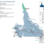
Explore the Best of Labrador with Scenic Driving Routes

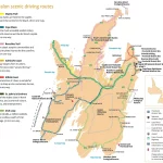
Labrador is a vast and breathtaking region in Canada, known for its rugged natural beauty, diverse wildlife, and fascinating cultural heritage. To explore this stunning destination, there’s no better way than hitting the open road and embarking on a scenic driving adventure. That’s where our Labrador Scenic Driving Routes Map comes in, helping you navigate … Read more

Home » national parks

Explore the Beauty of Central Newfoundland with this Tourist Map

This map shows cities, towns, the Trans-Canada highway, secondary roads, national parks, provincial parks, campgrounds, provincial/national historic sites, airports, local ferries, summer ferries, ski areas, golf courses, and provincial visitor information centers in Central Newfoundland.

Home » national parks

Experience the Best of Avalon with Scenic Driving Routes Map

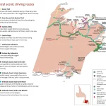
This map shows cities, towns, trails, Trans-Canada highways, secondary roads, national parks, provincial parks, provincial visitor information centers, provincial/national historic sites, ferries, airports, and natural scenic attractions in Avalon.

Home » national parks

Discover Central Newfoundland’s Scenic Beauty with our Driving Routes Map

This map shows cities, towns, trails, Trans-Canada highways, secondary roads, national parks, provincial parks, provincial visitor information centers, provincial/national historic sites, ferries, airports, and natural scenic attractions in Central Newfoundland.