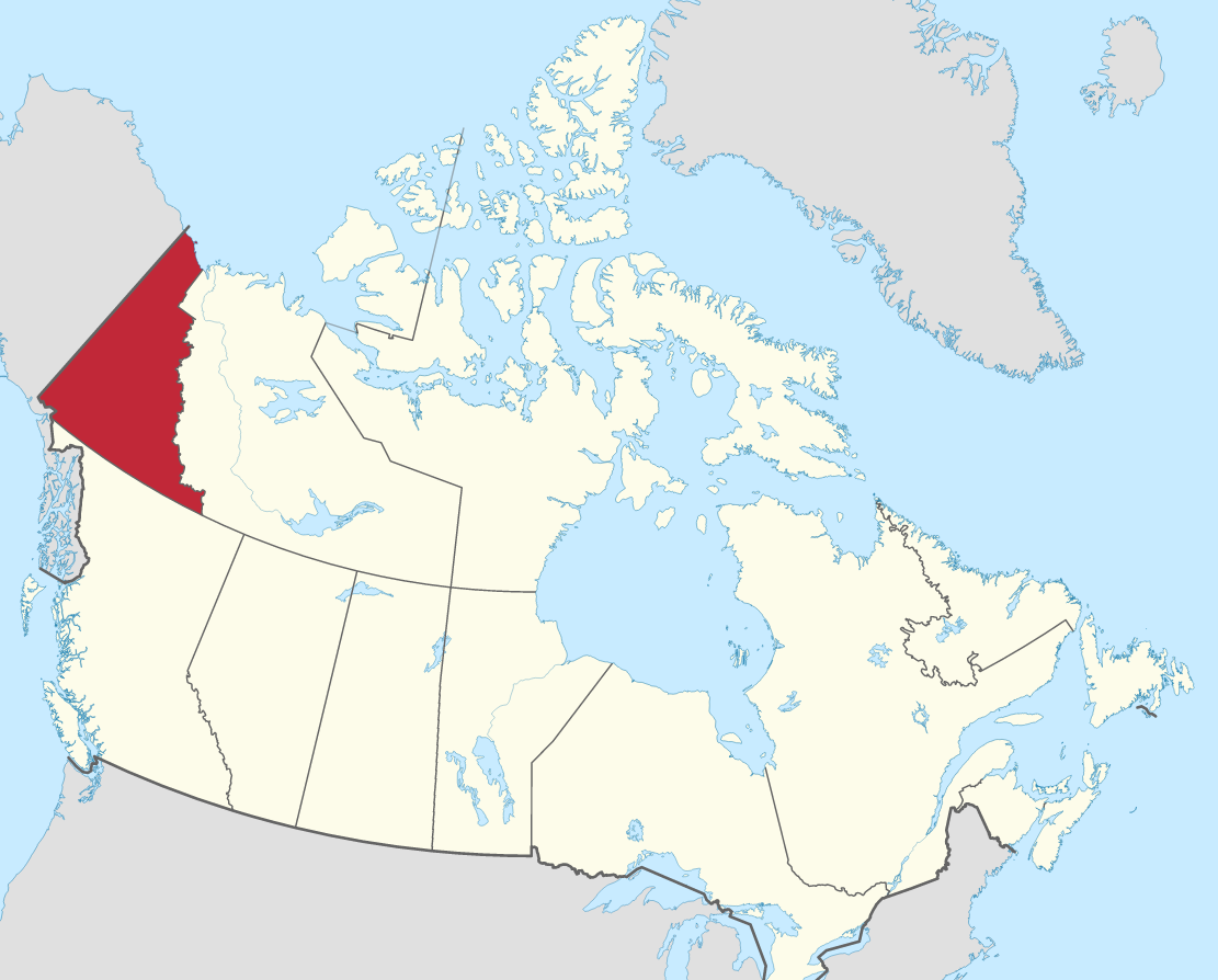
The Yukon facts
Capital: Whitehorse
Population: 44,412 (2023)
Date of Admission: 1898
Territorial motto: N/A
Provincial flower: fireweed
Time Zone: Pacific (PST) – (GMT − 8 hours)
Total Area (Sq Km): 482,443
Total Area (Sq Mi): 186,272
Time and date
Location
Quick links: About, Major places, History, Geography, Climate, Google Maps, Facts, What to do, Accommodation, Pictures, Useful information, Further readings.
There is a grandeur and beauty to this vast and thinly populated wilderness that only can be appreciated through experience. Having survived for thousands of years, the Aboriginal people hunt and trap as they always have. Few places in the world have remained so unchanged over time. Even though the Klondike Gold Rush soared the Yukon to its highest point in population, its legacy is fleeting and easily forgotten.
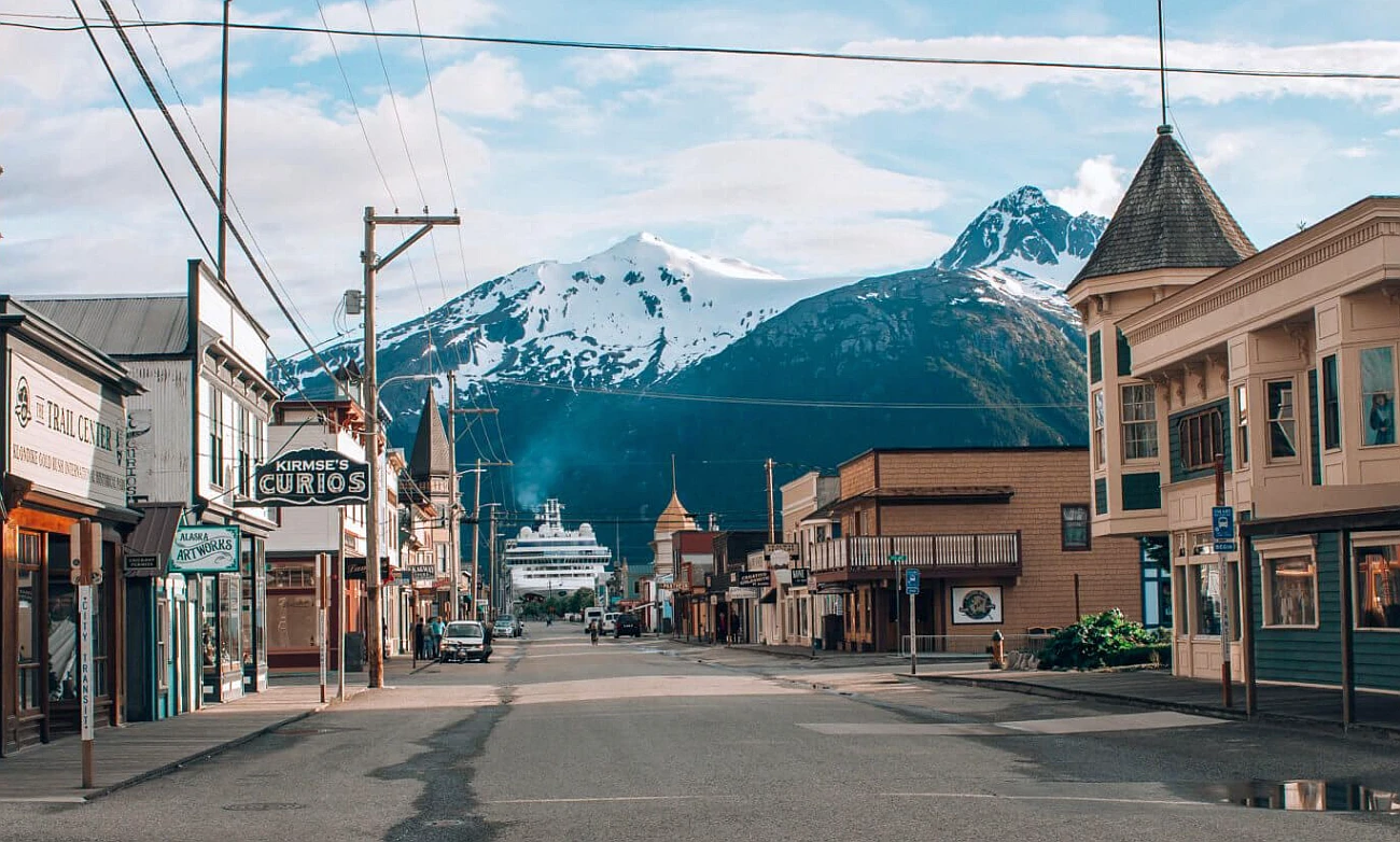
There are five of Canada’s tallest mountains in Kluane National Park and the largest ice fields beneath the Arctic, and you can go canoeing down the Yukon River. Don’t forget the people: enjoy the offbeat vibe of Dawson City and the bustle of Whitehorse, and join the growing number of visitors who have discovered Yukon due to TV shows like Yukon Gold and Dr. Oakley: Yukon Vet.
About the Yukon, Canada
Yukon, formerly Yukon Territory, is a territory of northern Canada, an area of rugged mountains and high plateaus. The Northwest Territories border the territory on the east, British Columbia on the south, and Alaska on the west. It extends northward to the Beaufort Sea above the Arctic Circle. Whitehorse is its capital. Yukon has been known for its mineral wealth since the Klondike gold rush of the late 1890s. Still, its remoteness from markets and Arctic climate have hindered its economic exploitation and modern settlement. This territory is among the few frontiers on the North American continent, sparsely populated and largely unspoiled. Area: 482,443 square kilometers / 186,272 square miles. Learn more about the location of the Yukon here.
Principal cities and towns
The largest 10 cities after their estimated population in 2022 are Saskatoon 337,000, Regina 262,320, Prince Albert 36,081, Moose Jaw 34,008, Swift Current 16,816, Yorkton 16,487, North Battleford 14,407, Lloydminster 12,215, Estevan 11,572, Melville 4,560.
History
There are many millennia of generations of descendants of those who migrated from Asia via the Bering Land Bridge to settle the region. It has been suggested that humans were established in the Old Crow Basin, in the northern part of Yukon, about 20,000 to 12,000 years ago, making it possibly the oldest site of human occupation in North America. Archaeological research into early human occupation has concentrated on the northern part of the Yukon.
In North America, the Yukon was one of the last areas explored by nonnatives. Among the First Nations populations inhabiting the Yukon during the time of European contact were the Southern and Northern Tutchone, Tlingit, Tagish, Kaska, Tanana, Han, and Gwich’in (Kutchin). In about 1840, two Hudson’s Bay Company explorers arrived in the region. John Bell crossed the Peel River from the north, while Robert Campbell crossed the Liard River from British Columbia. Threats from the outside, like newcomers and their friendship treaties with some regional First Nations peoples, were enough to cause Fort Yukon to be abandoned. As tensions began to rise in 1843, an attempt was made by the company to build trading posts in the south, but conflicts soon kicked up between the fort and First Nations people. Attempts to establish a new trading post nearby were made from 1847 to 1867 but then abandoned until 1890, when it was relocated again after Alaska became part of the U.S. under Russian protection than American.
Geography
Even though much of the territory is still unspoiled, people’s environmental impact is evident. Forest fires have often gone uncontrolled in remote places due to reliance on wood for fuel near the settlements. In addition, surface mining has scarred the landscape near Dawson, the west-central part of the territory, and Whitehorse.
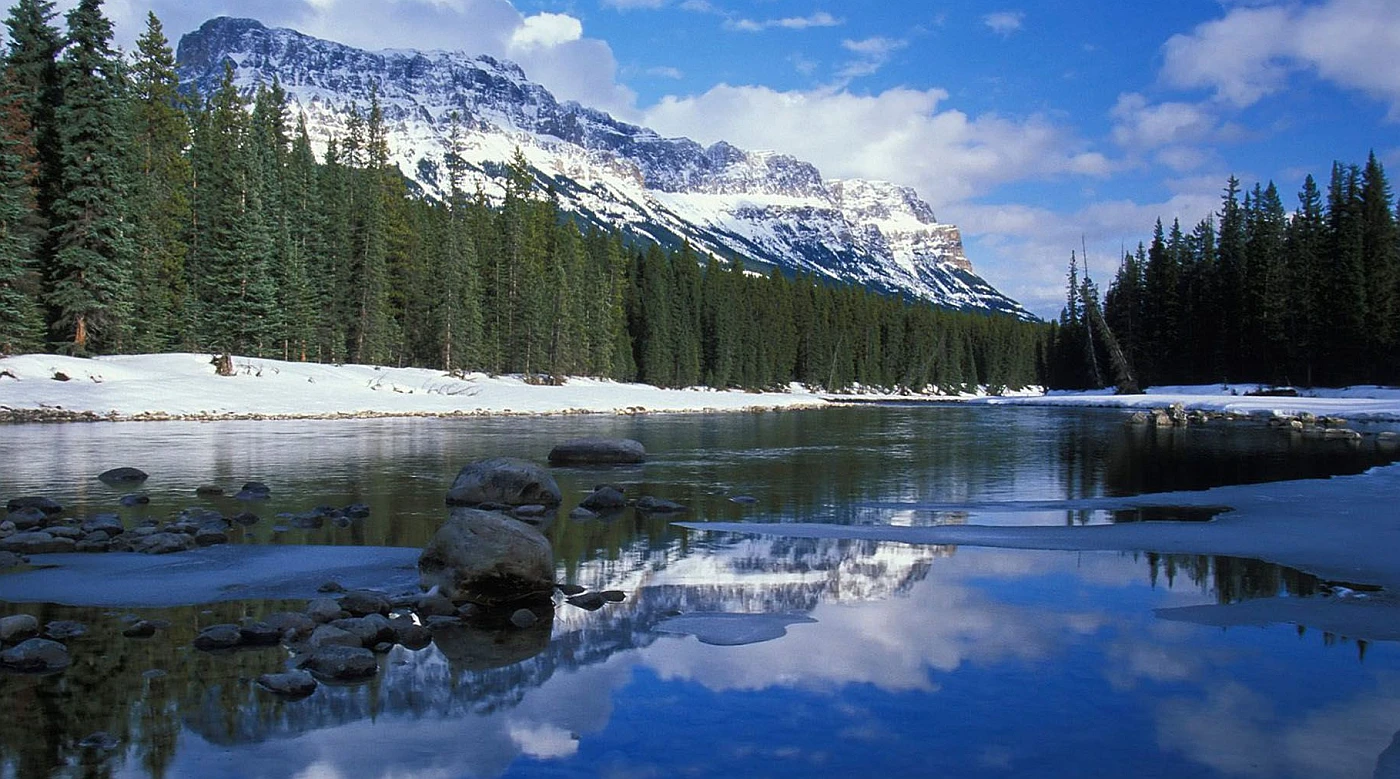
Yukon lies within the mountainous Cordilleran region of western North America. The largest settlements in this province lie in a large central plateau surrounded by mountains, notably the Selwyn and Mackenzie ranges of the Rockies to the east; the Logan, Pelly, and St. Elias range to the south; and the Ogilvie and Richardson range to the west and north. Some of these mountains are spectacular, especially Mount St. Elias, at 5,489 meters / 18,008 feet on a border with Canada, where notable peaks include Mount Logan at 5,959 meters / 19,551 feet, and Mount Hayden, which is 5,467 meters / 17,884 feet.
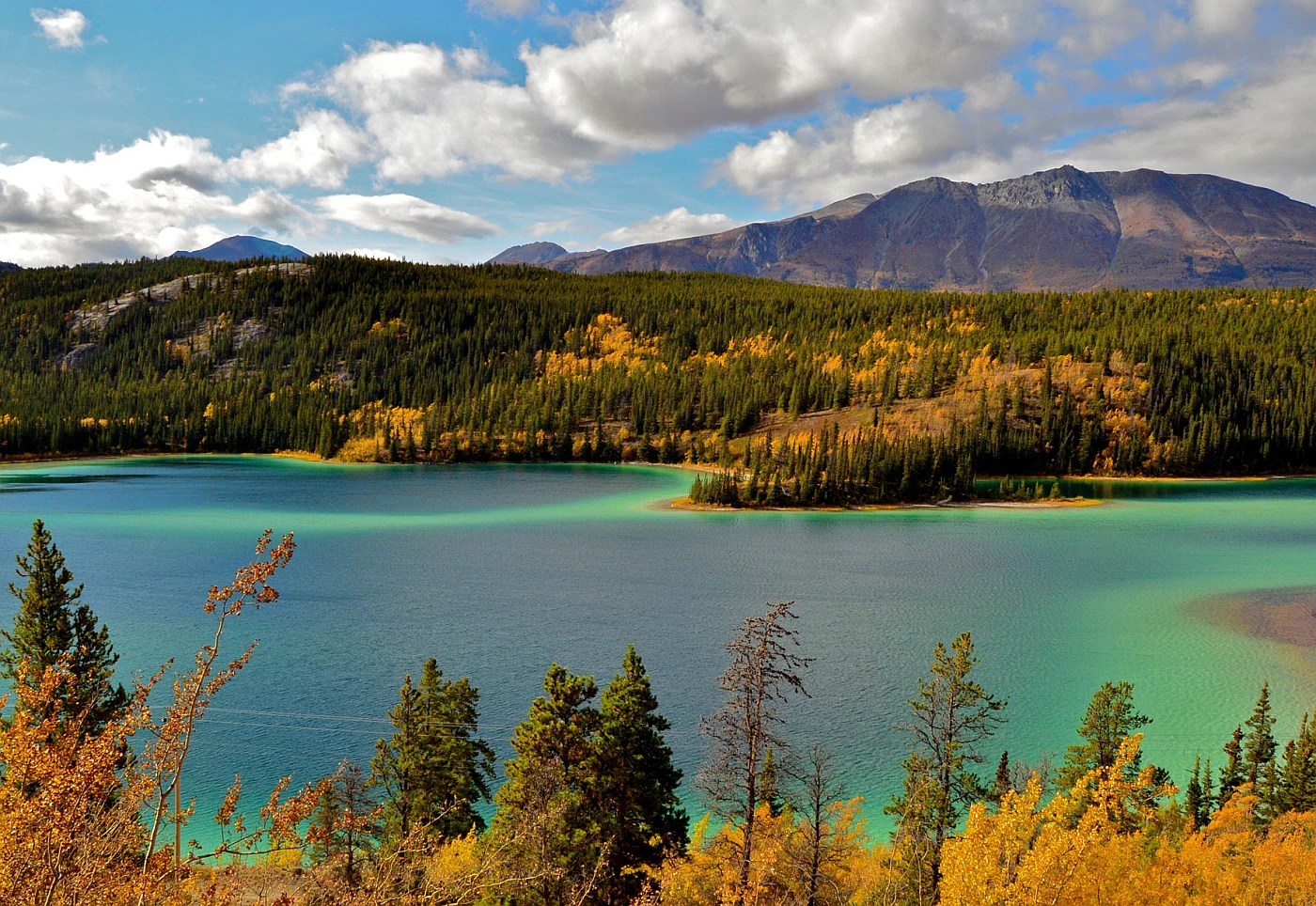
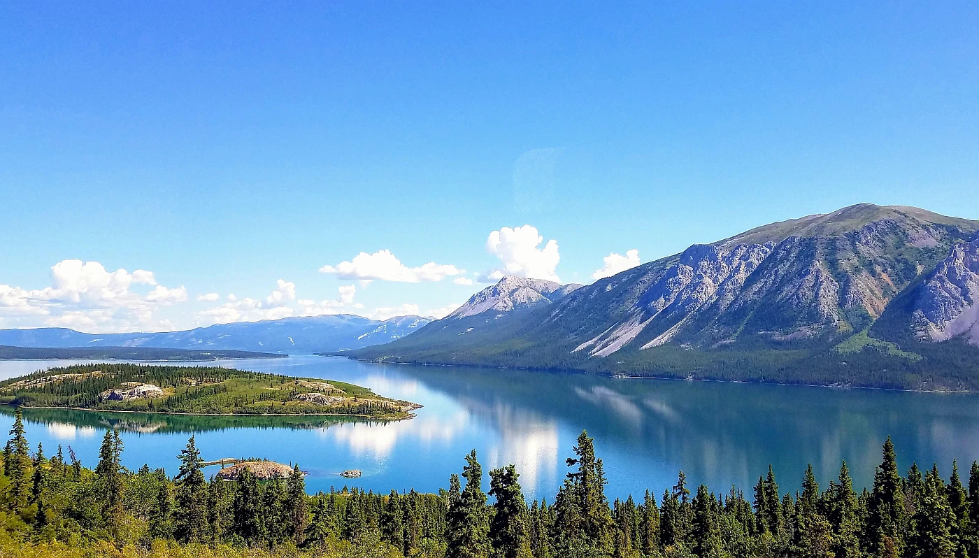
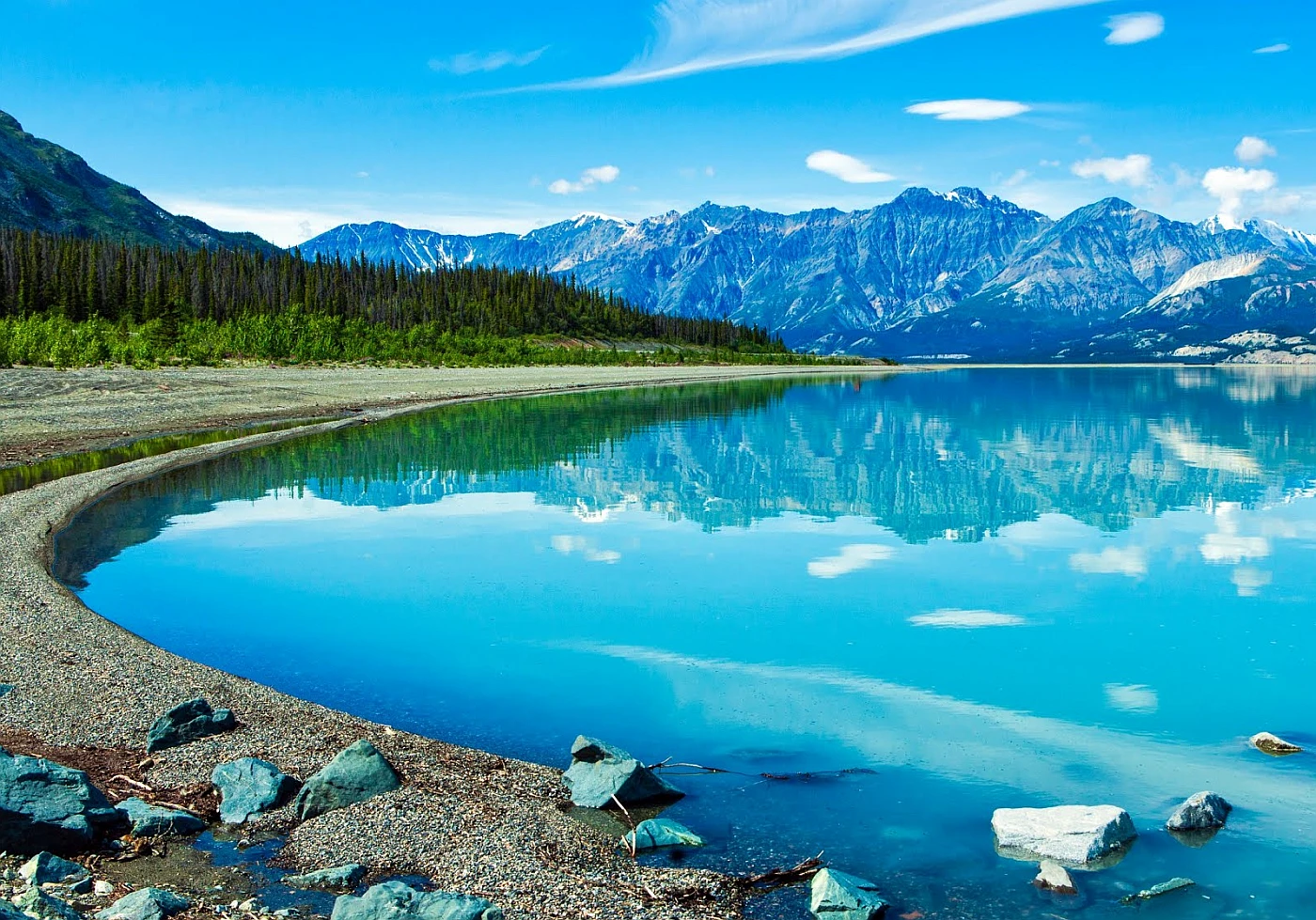
In the south, there is the Pelly, Macmillan, Stewart, White, and Klondike. In the north is the Porcupine; most of the territory is drained by the Yukon River, which flows northwestward into Alaska and its tributaries. Liard and Peel, both tributaries of the Mackenzie, flow north through the adjacent Northwest Territories to the Arctic Ocean and are important rivers. There are also numerous scenic alpine lakes in Yukon, the best known being Kluane and Aishihik in the St. Elias Mountains. Other large lakes in the southern part of the territory include Teslin, Laberge, and Kusawa. In the north, large stretches of flat and poorly drained tundra with widespread permafrost, a permanently frozen ground that makes construction difficult.
Yukon is known for its rugged wilderness and natural beauty, and many lakes are there.
Due to the dry, cool climate and poor soils of many regions, there is little vegetation. Some southern valleys are heavily forested, while the extreme northern portion of Yukon is above treeline. It is common to find orchids blooming in the summer near lakes and wetlands where aquatic vegetation thrives.
Yukon is home to various animal species, including grizzly bears, Dall sheep, and smaller fur-bearing mammals. In addition to waterfowl, muskrats and other typical North American birds inhabit wetlands. The Arctic grayling, lake trout, and northern pike are common fishes.
Climate
Yukon’s summers are short, but its days are long, especially in its northern part, which lies above the Arctic Circle. The average monthly readings are not unlike those in some Canadian cities farther east and south, where temperatures can reach summer highs of about 35°C / mid-90s F and winter lows below about −50 °C / -60s F. At Whitehorse, precipitation averages only about 250 millimeters / 10 inches annually.
Google Maps the Yukon
Please click here for driving directions.
Google Street View is a feature of Google Maps that provides 360-degree panoramic images of many locations worldwide. These images are captured by Google’s Street View vehicles, which drive around the streets and take pictures of the surrounding area. Here are a few exciting objects and locations that Google Street View in the territory of Yukon has captured:
- The Northern Lights: Google Street View has captured images of the Northern Lights, or Aurora Borealis, over the territory of Yukon. These images show the stunning and colorful displays of light in the night sky in the northern parts of the world.
- The Klondike Highway: Google Street View has captured images of the Klondike Highway, which runs through the territory of Yukon and offers stunning views of the surrounding landscape, including mountains, forests, and lakes.
- The White Pass and Yukon Route Railway: Google Street View has captured images of the White Pass and Yukon Route Railway. This historic narrow-gauge railway runs through the territory of Yukon and offers scenic rides through the mountains and forests.
- The S.S. Klondike National Historic Site: Google Street View has captured images of the S.S. Klondike National Historic Site. This preserved steamboat was once used to transport goods and people through the territory of Yukon.
- The Midnight Dome: Google Street View has captured images of the Midnight Dome, a granite peak located in the territory of Yukon that offers panoramic views of the surrounding landscape.
Did you know?
- As the westernmost territory of Canada (along with the Northwest Territories and Nunavut), the Yukon has historically been governed by the federal government but has recently gained more provincial powers.
- The Yukon borders Alaska to the west, the Beaufort Sea of the Arctic Ocean to the north, the Northwest Territories to the east, and Alaska and British Columbia to the south.
- Despite its small size (482,443 km2 / 186,272 mi2), the Yukon is more significant than four of Canada’s 10 provinces (Prince Edward Island, Nova Scotia, New Brunswick, Newfoundland, and Labrador).
- The Yukon is about twice as large as the United Kingdom or about the same size as Spain or Turkmenistan.
- Despite being smaller than the other two territories, the Yukon has the highest population density (0.09 people per km2).
- In the Yukon Beringia Interpretive Centre, you can learn about the Ice Age that formed the Beringia Land Bridge, which once linked North America and Asia and let people walk to the Yukon from Asia.
- In the Yukon, 23 percent of the population is indigenous, more than any other province, but the lowest among the three territories. This includes 14 First Nations spanning 8 languages that are crucial to the territory’s management.
- Mount Logan is 5,959m high: This peak is the second tallest in North America. Seventeen of the tallest 20 mountains in Canada are in the Yukon.
- In summer, the Midnight Sun shines all day and night in some parts of the Yukon.
What to do in the Yukon
The Yukon is a beautiful and unique place to visit, with a wide range of outdoor activities to enjoy. Some popular activities in the Yukon include:
- Hiking: The Yukon has a vast network of trails that offer stunning views and the opportunity to explore the wilderness. You can find trails for all skill levels, from short and easy to long and challenging.
- Wildlife viewing: The Yukon is home to various wildlife, including bears, moose, caribou, and wolves. There are many tour operators that offer guided wildlife viewing expeditions.
- Fishing: The Yukon is home to numerous rivers and lakes, making it an excellent place for fishing. You can catch a variety of species, including salmon, trout, and arctic grayling.
- Whitewater rafting: The Yukon’s rivers offer exciting opportunities for whitewater rafting, with trips available for all skill levels.
- Dog sledding: The Yukon is known for its long, cold winters and is the perfect place to try dog sledding. You can go on a guided tour or try to muster a team of sled dogs.
- Skiing and snowboarding: The Yukon’s winters are long and cold, making it a great place for skiing and snowboarding. There are several ski resorts in the area that offer a variety of trails for all skill levels.
- Aurora viewing: The Yukon is located in the auroral zone, making it a great place to view the Northern Lights. The best time to see the aurora is in winter when the nights are long, and the skies are clear.
These are just a few examples of the many activities you can enjoy in the Yukon. There are many more opportunities to explore the great outdoors, try new things, and experience the region’s unique culture.
Accommodation in the Yukon
Many of Whitehorse’s accommodations are booked well in advance in high summer, but the city has plenty of accommodations. If you arrive without a reservation, contact the visitor center or try the string of hotels on Main Street between the 1st and 5th avenues. While the Wal-Mart car park is free for RVs, Whitehorse also has many nicer RV and campsite sites.
Reserve a room
Our tip for accommodation in the Yukon territory would be to consider staying in a “wilderness lodge” or “backcountry camping”. The Yukon is known for its rugged wilderness and outdoor activities like hiking, fishing, and viewing wildlife. Staying in a wilderness lodge can provide an opportunity to experience the region’s natural beauty and enjoy these activities in a comfortable and safe environment. Many lodges offer all-inclusive packages that include meals, activities, and transportation to and from the lodge.
Another option would be backcountry camping, which can provide an opportunity to truly immerse oneself in the wilderness and experience the region’s natural beauty. If you’re considering this option, it’s essential to be prepared for the weather and wilderness conditions and to have the necessary gear and supplies.
Alternatively, you can also consider staying in a city like Whitehorse, where you will have access to a wide range of accommodation options, from budget-friendly hostels and hotels to luxury resorts and a variety of cultural and entertainment opportunities.
Pictures
Useful information
From the west in Alaska, there are three main ways to travel into the Yukon, and from the south in British Columbia, there are two. There are unique sites to see along each highway, but the real beauty lies in the Yukon, with nearly 5,000 km / 3107 mi of well-maintained roads eager to be crossed by your wheels.
Whitehorse is a hub for the Yukon. Not only can you get to most other points in the territory from it, but a few bus/train combinations make it possible to explore the entire territory and reach BC and Alaska. Public transport is limited in Whitehorse; however, it will get you to surprisingly remote places and how-to-see spots with changing schedules. Ask tourist information centers or call bus and train providers for details on the latest updates.
The road conditions and closures can be found at 511yukon.ca. If you have questions about how this might impact your plans, our Travel Counselors have lots of helpful information and will be happy to assist. You can reach them at 1-800-661-0494 or [email protected].
Distances from Whitehorse
- Anchorage 1165km / 722 miles
- Beaver Creek 457km / 285 miles
- Burwash Landing 285km / 178 miles
- Carcross 74km / 46 miles
- Dawson City 535km / 332 miles
- Edmonton 1982km / 1225 miles
- Fairbanks 980km / 609 miles
- Fort Nelson 946km / 591 miles
- Haines / 259 miles
- Haines Junction 158km / 99 miles
- Inuvik 1226km / 763 miles
- Prince George 1880km / 1170 miles
- Seattle 2831km / 1759 miles
- Tok 639km / 397 miles
- Vancouver 2702km / 1680 miles
- Watson Lake 436km / 271 miles
Flying to the Yukon: There are many ways to get to the Yukon, but flying is definitely the easiest. You can catch regular flights with Air North on its route from Vancouver, Calgary, Edmonton, Ottawa, Kelowna, Victoria, and Yellowknife. Another option is if you’re coming from further abroad, other major airlines provide convenient flights, such as Air Canada, WestJet, and Condor, that arrive in the Yukon via other major airports.
You may also be interested in
- Alberta
- British Columbia
- Manitoba
- New Brunswick
- Newfoundland and Labrador
- Northwest Territories
- Nova Scotia
- Nunavut
- Ontario
- Prince Edward Island
- Quebec
- Saskatchewan
- Yukon
Did you like this Yukon map and information page? Please don’t forget to share or bookmark this content on Canada Maps.com!