Nunavut is Canada’s largest and most northern territory, spanning over 2 million square kilometers. Despite its size, Nunavut is sparsely populated, with just over 30,000 residents living in the area. However, Nunavut is rich in natural beauty, with vast tundras, glaciers, and a stunning coastline overlooking the Arctic Ocean. CanadaMaps.com proudly presents a detailed map of Nunavut showcasing the territory’s cities, towns, rivers, lakes, Trans-Canada highways, major highways, secondary roads, winter roads, railways, and national parks.
Large Detailed Map of Nunavut
This map shows Nunavut’s cities, towns, rivers, lakes, Trans-Canada highways, major highways, secondary roads, winter roads, railways, and national parks.
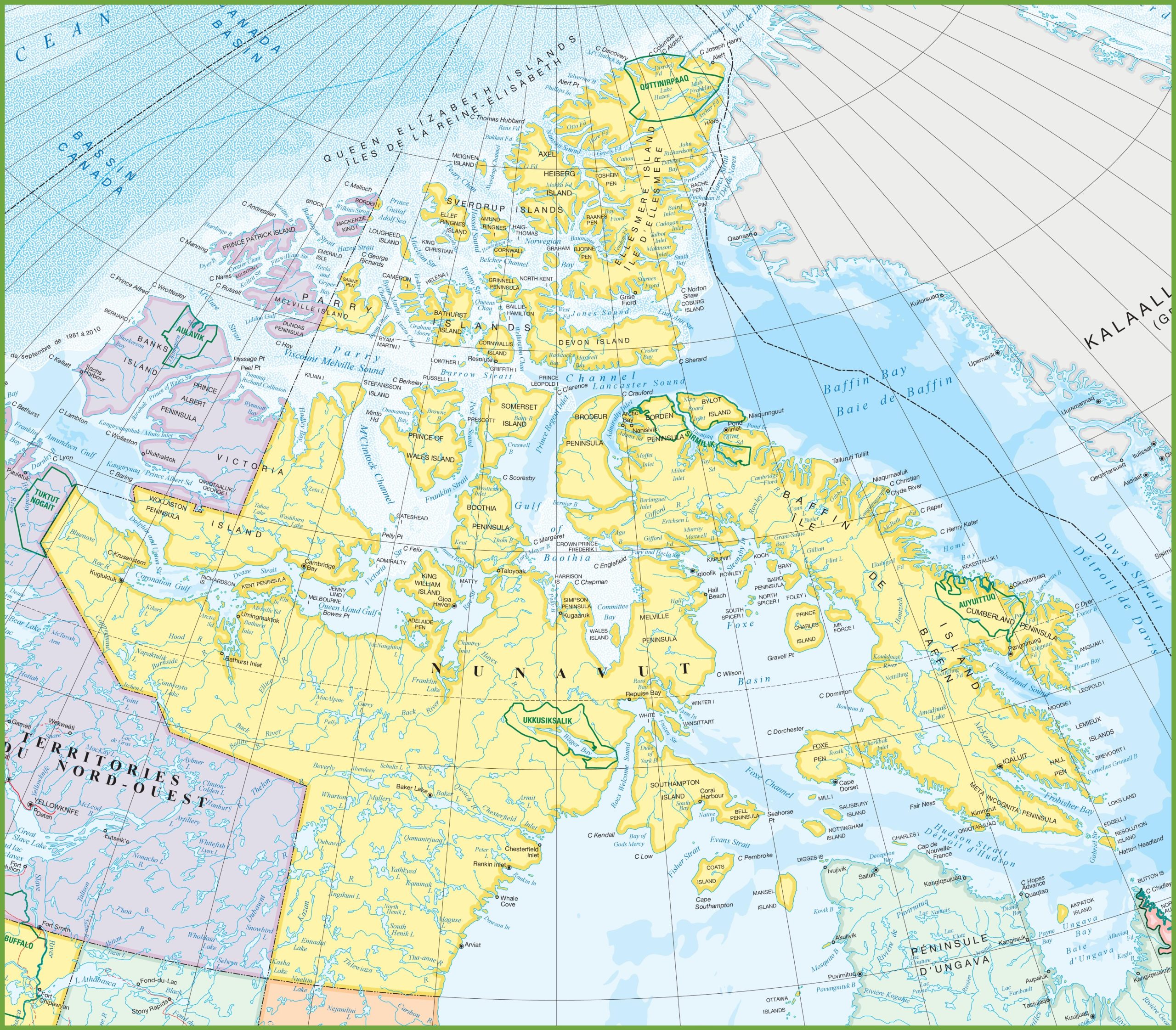
The large detailed map of Nunavut, displayed at a resolution of 2560×2243 pixels, offers an extensive overview of Canada’s largest and newest territory. This map is a vital resource for understanding the geography of this remote region, which is characterized by its Arctic tundra, vast distances, and sparse population.
The map likely includes the locations of small communities, hamlets, and significant landmarks throughout the territory. It also shows the intricate network of rivers and lakes that define the landscape and the territorial boundaries that separate Nunavut from its neighboring regions.
Given the map’s scale, it would be an excellent tool for educational purposes, providing insights into the topography and settlement patterns of Nunavut. It would also be useful for anyone planning to travel or conduct research in the area, offering a detailed representation of the territory’s infrastructure, such as roads, which are few, and airstrips, which are essential for transportation, given the lack of road connectivity between communities.
Please visit this page for other map resources or Google Maps.
What are large detailed maps used for?
Detailed maps are invaluable for various purposes, including travel planning, navigation, and education. With a map of Nunavut, you can easily identify the location of cities and towns, plan road trips, and learn about the natural features and landmarks of the region. Whether you are a seasoned traveler or a geography student, a detailed map of Nunavut can provide valuable information about this fascinating region.
Did you know about Nunavut?
- Nunavut is one of Canada’s most unique and culturally diverse regions, home to several indigenous communities. Nunavut is the only region in Canada where most of the population is indigenous.
- Nunavut covers over 20% of Canada’s total land area, making it the country’s largest and most sparsely populated territory.
- Nunavut was established as a separate territory in 1999, following a historic land claims agreement between the Canadian government and the Inuit people.
- The territory is home to some of Canada’s most iconic wildlife, including polar bears, caribou, and narwhals.
- The territory is home to several Inuit communities, each with its distinct language and culture.
- Nunavut is also known for its stunning natural landscapes, including the northern lights, glaciers, and the Arctic Ocean.
- Additionally, Nunavut is home to some of the world’s oldest and most well-preserved archaeological sites, dating back over 4,000 years.
Conclusion
Whether you’re planning a trip to Nunavut or simply interested in learning more about Canada’s northernmost territory, our detailed map is an excellent resource. With its comprehensive view of Nunavut’s cities, towns, rivers, lakes, highways, and national parks, our map is perfect for exploring the territory’s vast and beautiful landscape.