Welcome to CanadaMaps.com, your one-stop shop for detailed maps of Canada. In this blog post, we’ll explore the beautiful province of Ontario, known for its vast landscapes, charming towns, and bustling cities. Our map provides a comprehensive overview of the province, highlighting the key highways, cities, and points of interest that make Ontario a popular destination for tourists and locals.
Ontario Highway Map
This map shows highways in Ontario. Cities, towns, counties, interprovince highways, Canada highways, province highways, main roads, secondary roads, rivers, lakes, airports, national parks, rest areas, welcome centers, Indian reservations, scenic byways, and points of interest in Ontario. Hotels, resorts, beaches, national parks, rest areas, welcome centers, Indian reservations, scenic byways, points of interest, tourist attractions, and sightseeing in Ontario.
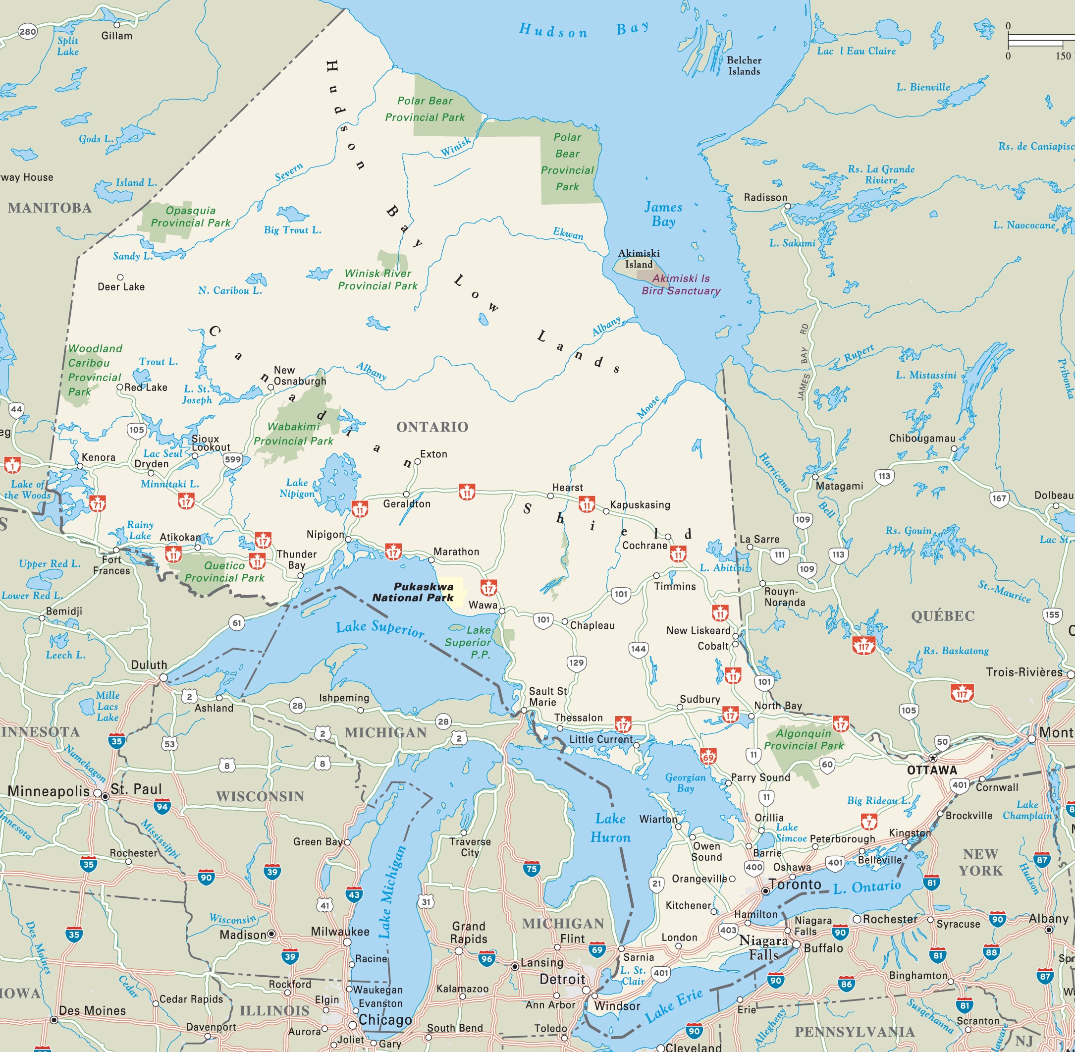
The Ontario highway map is an expansive visual guide rendered at a high resolution of 2170×2123 pixels. It provides a detailed layout of Ontario’s highway system, including major highways and secondary roads, as well as provincial parks and natural landmarks. The map is designed to assist travelers in navigating the province, highlighting the connections between urban centers and the natural beauty of Ontario’s countryside.
Please visit this page for other map resources or Google Maps.
What Are Such Maps Used For?
Maps of Ontario are an essential tool for anyone traveling within the province, providing valuable information about the area’s highways, cities, towns, and natural features. This map of Ontario is a must-have resource for anyone planning a road trip or visiting the province, as it shows the main highways, interprovince highways, Canada highways, province highways, main roads, secondary roads, and points of interest, including national parks, rest areas, welcome centers, Indian reservations, scenic byways, and tourist attractions.
Did You Know About Canada?
Ontario, the most populous province in Canada, is home to several major cities, including Toronto, Ottawa, and Hamilton. The map highlights the location of these cities, along with several smaller towns and counties that are popular with tourists. It also shows the location of several airports in the province, making it easy for visitors to plan their travel arrangements.
In addition to its bustling cities and charming towns, Ontario is home to several natural attractions, including national parks, lakes, and rivers. The map shows the location of these natural features, rest areas, and welcome centers, making it easy for travelers to take a break and enjoy the beautiful scenery. It also highlights several Indian reservations, scenic byways, and points of interest, providing visitors with various experiences.
Conclusion
In conclusion, this map of Ontario is an essential tool for anyone planning a trip to the province. It provides visitors with valuable information about the key highways, cities, and points of interest in the area, making it easy to navigate and plan their trip. Whether planning a road trip, visiting a national park, or exploring a scenic byway, this map will help you make the most of your time in Ontario.