New Brunswick is a beautiful province located in eastern Canada, known for its stunning coastline, lush forests, and charming towns and cities. Our map of New Brunswick with cities and towns is the perfect tool to help you explore this charming province. In this blog post, we’ll explore what this map shows, what such maps are used for, and some interesting facts related to New Brunswick.
Map of New Brunswick With Cities and Towns
This map shows cities, towns, highways, main roads, secondary roads, rivers, lakes, national parks, and provincial parks in New Brunswick.
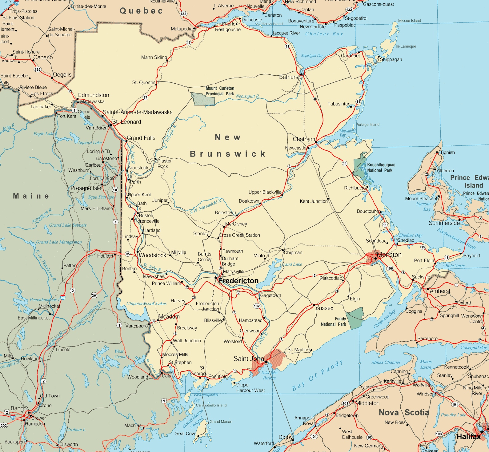
The map of New Brunswick with cities and towns is a detailed visual representation with a resolution of 1589×1470 pixels. It provides a comprehensive view of the province’s urban and rural areas, marking the locations of cities, towns, and the network of roads that connect them. The map also includes significant geographical features such as rivers and coastal lines, and it also highlights natural attractions and points of interest, making it an invaluable tool for navigation and planning visits to New Brunswick’s diverse regions.
Please visit this page for other map resources or Google Maps.
What does this New Brunswick map show?
Our New Brunswick map with cities and towns is designed to be comprehensive, showing all significant features of the province, including highways, main roads, secondary roads, rivers, lakes, national parks, and provincial parks. The map is easy to read and includes information on the distances between cities and towns, making it easy to plan your route and navigate the province.
What are such maps used for?
Maps like ours are essential for anyone planning a trip to New Brunswick. Our map can help you plan your route, identify the cities and towns you want to visit, and better understand the area’s geography. Whether you’re planning a long road trip or a short weekend getaway, our map is the perfect tool to help you explore the beauty of New Brunswick.
Did you know about New Brunswick?
- New Brunswick is home to the highest tides in the world, which can reach up to 16 meters in height in some areas. The Bay of Fundy is a popular spot to witness these tides and is home to many unique species of plants and animals.
- The province also has several charming towns and cities, including Saint John, Fredericton, and Moncton. Saint John is known for its rich history and architecture, and Fredericton is the capital city. It is known for its vibrant cultural scene, and Moncton is a bustling city with plenty of shopping and entertainment options.
- New Brunswick is a great destination for outdoor enthusiasts, with plenty of hiking trails, fishing spots, and camping areas. The province also has several national and provincial parks, including Fundy National Park and Kouchibouguac National Park.
Conclusion
In conclusion, our New Brunswick map with cities and towns is an essential resource for anyone planning a trip to explore the beauty of this stunning Canadian province. With its comprehensive coverage of all significant features of the province, including highways, main roads, secondary roads, rivers, lakes, national parks, and provincial parks, our map can help you plan your route and discover the unique natural and cultural wonders of New Brunswick. Whether you’re a history buff, a foodie, or an outdoor enthusiast, our map is the perfect tool to help you explore the charm of New Brunswick.