Manitoba is a stunning Canadian province in the heart of the country, known for its beautiful lakes, rivers, forests, and vibrant cities and towns. Our large detailed map of Manitoba with cities and towns is the perfect tool to help you discover the many wonders of this beautiful province. In this blog post, we’ll explore what this map shows, what such maps are used for, and some interesting facts about Manitoba.
Large Detailed Map of Manitoba with Cities and Towns
This map shows cities, towns, rivers, lakes, Trans-Canada highways, major highways, secondary roads, winter roads, railways, and national parks in Manitoba.
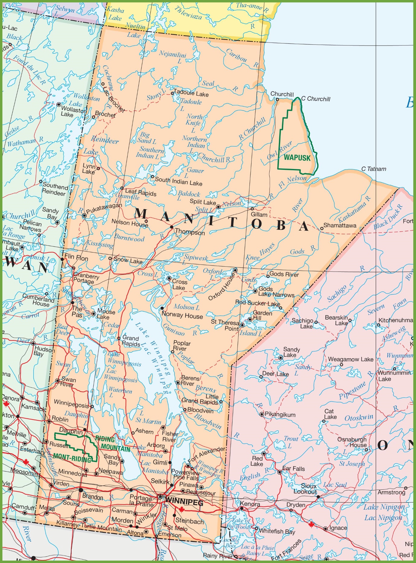
The map of Manitoba with cities and towns is a detailed visual guide presented at a resolution of 1378×1866 pixels. It offers a comprehensive overview of the province, including its urban centers, smaller communities, and the connecting roadways. The map likely features prominent geographical landmarks such as lakes and rivers and indicates provincial parks and other points of interest. This map is a valuable resource for anyone looking to explore Manitoba, from the capital city of Winnipeg to the northern lakes and remote towns.
Please visit this page for other map resources or Google Maps.
What does this Manitoba map show?
Our Manitoba map with cities and towns is designed to be comprehensive, showing all major features of the province, including highways, main roads, secondary roads, winter roads, railways, rivers, lakes, and national parks. The map is easy to read and includes information on the distances between cities and towns, making it easy to plan your route and navigate the province.
What are such maps used for?
Maps like ours are essential for anyone planning a trip to Manitoba. Our map can help you plan your route, identify the cities and towns you want to visit, and better understand the area’s geography. Whether you’re planning a long road trip or a short weekend getaway, our map is the perfect tool to help you explore the beauty of Manitoba.
Did you know about Manitoba?
- Manitoba is known as the “Land of 100,000 Lakes” due to its abundance of beautiful freshwater lakes. The province is also home to several major rivers, including the Red and Assiniboine Rivers.
- The province has several vibrant cities and towns, including Winnipeg, Brandon, and Churchill. Winnipeg is the capital city known for its rich cultural scene, museums, and art galleries. Brandon is a bustling city with plenty of shopping and entertainment options, and Churchill is a unique town located on the shores of Hudson Bay, known for its polar bears and beluga whales.
- Manitoba is a great destination for outdoor enthusiasts, with plenty of fishing, hunting, camping, and hiking opportunities. The province is also home to several national and provincial parks, including Riding Mountain National Park and Whiteshell Provincial Park.
Conclusion
In conclusion, our large, detailed map of Manitoba with cities and towns is an essential resource for anyone planning a trip to explore the beauty of this stunning Canadian province. With its comprehensive coverage of all significant features of the province, including highways, main roads, secondary roads, winter roads, railways, rivers, lakes, and national parks, our map can help you plan your route and discover the unique natural and cultural wonders of Manitoba. Whether you’re a nature lover, a history buff, or an outdoor enthusiast, our map is the perfect tool to help you explore the beauty of Manitoba.