Welcome to CanadaMaps.com, where we provide comprehensive maps of Canada to help you explore and navigate the country. This blog post will focus on the Alberta province and its many tourist attractions. Our map showcases the key destinations in Alberta, providing visitors with a valuable tool for planning their trip and navigating the province.
Alberta Tourist Map
This map shows cities, towns, regions, visitor information centers, UNESCO world heritage sites, airports, primary highways, Trans-Canada, Crowsnest, and U.S. ports of entry.
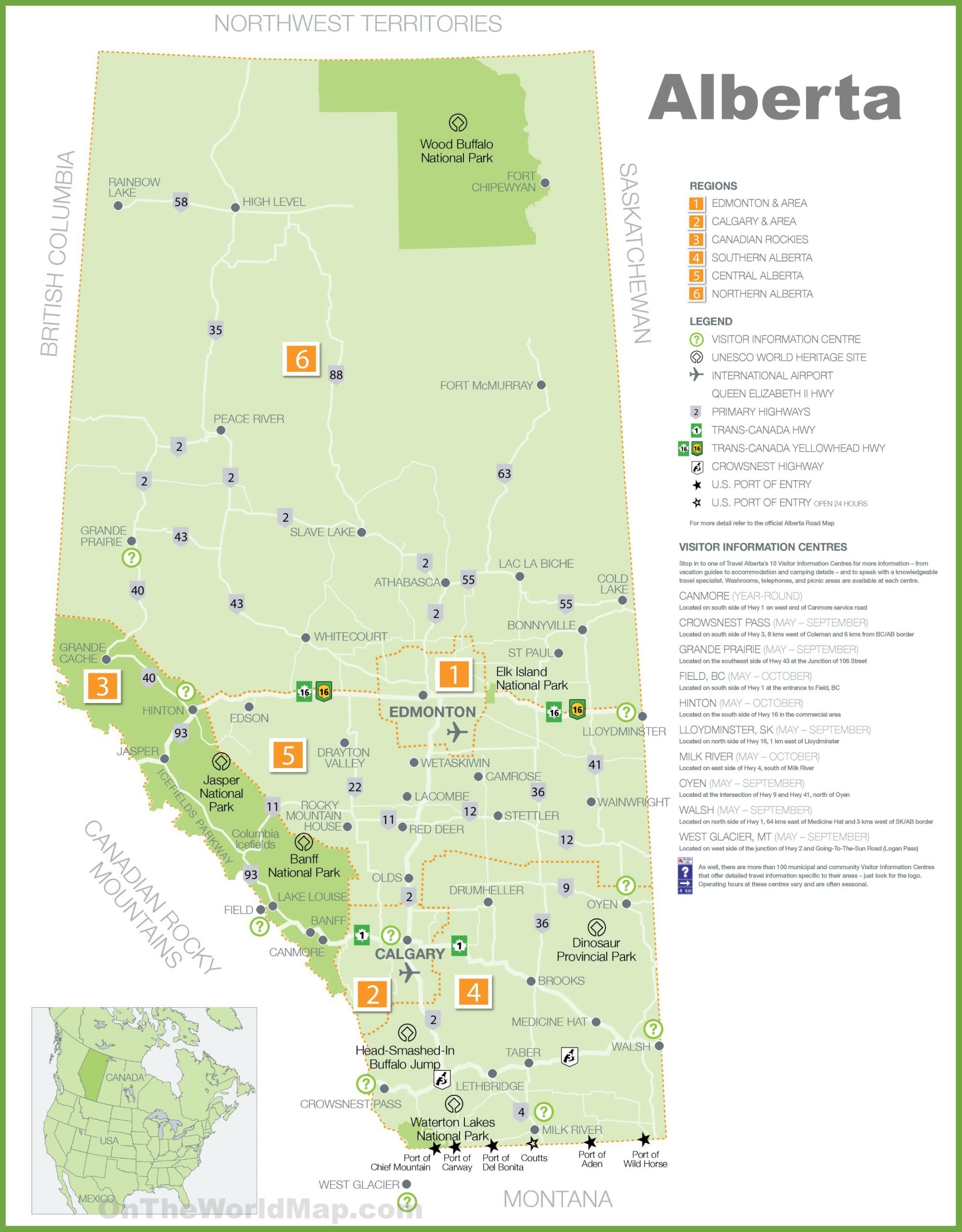
This Alberta tourist map, with a resolution of 1999×2560 pixels, is a colorful and informative guide for visitors to the province. It highlights key attractions, visitor information centers, UNESCO World Heritage Sites, international airports, and major highways, including the Trans-Canada and Yellowhead routes. The map is divided into regions such as Edmonton & Area, Calgary & Area, Canadian Rockies, Southern Alberta, Central Alberta, and Northern Alberta, making it easy to plan a trip that covers diverse experiences. Icons and a legend help travelers locate essential services and points of interest, from cultural sites to natural wonders.
Please visit this page for other map resources or Google Maps.
What Such Maps Are Used For?
Tourist maps are an essential tool for visitors to a new destination, providing valuable information about the area’s key attractions, cities, towns, and regions. This map of Alberta is an indispensable resource for anyone planning a trip to the province, providing them with valuable information about the UNESCO World Heritage Sites, airports, and ports of entry. It also highlights the province’s key cities and towns and the visitor information centers that can help travelers plan their itinerary.
Did You Know About Canada?
Alberta is home to four UNESCO World Heritage Sites showcasing the province’s natural beauty and cultural heritage. The map highlights these sites, including the Dinosaur Provincial Park, Head-Smashed-In Buffalo Jump, Wood Buffalo National Park, and the Canadian Rocky Mountain Parks. These sites are significant to Alberta’s history and offer visitors a unique and memorable experience.
The map also features the major highways in Alberta, including the Trans-Canada Highway and the Crowsnest Highway, which provide visitors with access to the province’s many attractions. Additionally, it shows the U.S. ports of entry, making it easier for visitors traveling from the United States to plan their trip.
Conclusion
In conclusion, this tourist map of Alberta is an essential tool for anyone planning a trip to the province. It provides visitors with valuable information about the key destinations, UNESCO World Heritage Sites, airports, and ports of entry. It also showcases the beauty and diversity of Alberta’s landscape, from the rugged Rocky Mountains to the rolling prairies. Whether you’re planning a road trip or visiting one of the province’s many attractions, this map will help you make the most of your time in Alberta.