Welcome to CanadaMaps.com, where we provide comprehensive maps of Canada to help you explore and navigate the country. This blog post will focus on the Alberta province and its extensive road network.
Alberta Highway Map
This map shows highways, main roads, and secondary roads in Alberta.
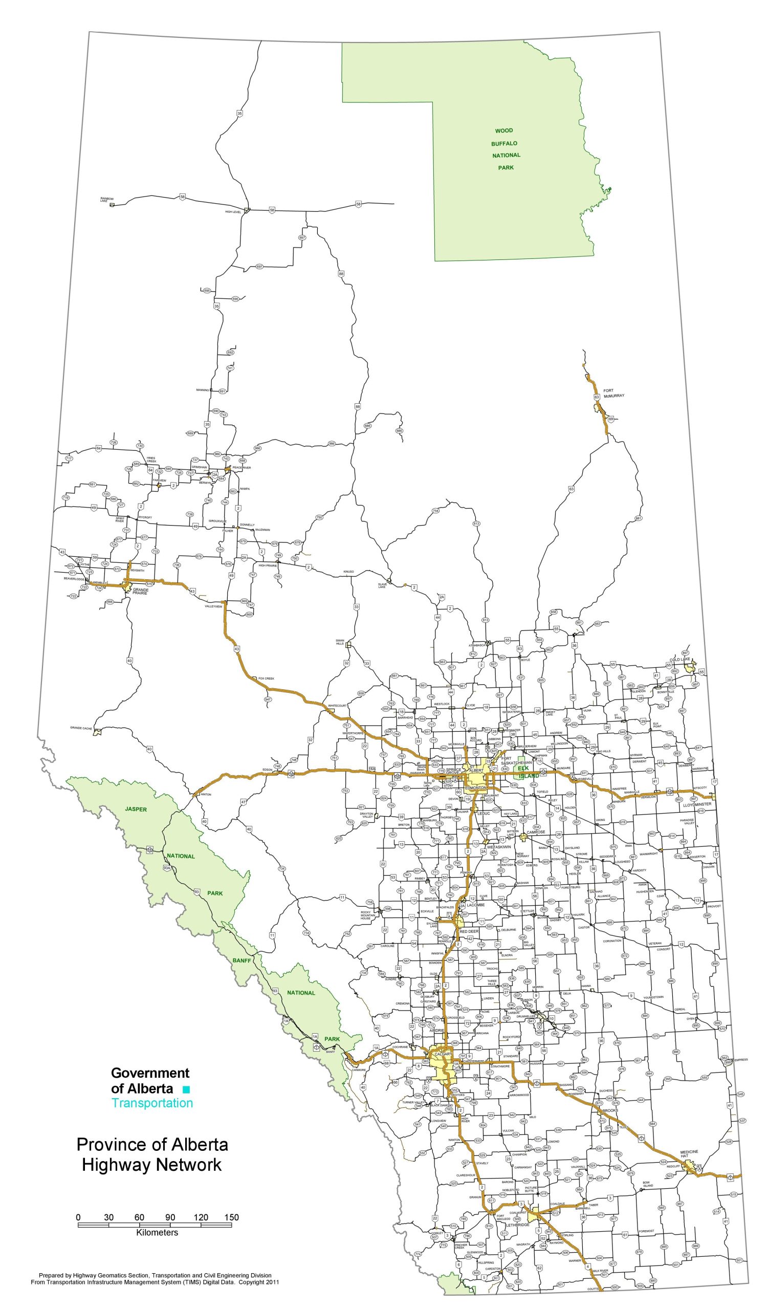
The Alberta highway map is a detailed representation of the province’s highway network, showcasing a complex web of transportation routes. At a high resolution of 1501×2560 pixels, this map details major highways, secondary roads, and key geographic markers such as national parks and urban centers. It’s a practical resource for planning road trips and understanding the infrastructure that supports travel and commerce throughout Alberta.
Please visit this page for other map resources or Google Maps.
What Are Such Maps Used For?
Maps are an essential tool for planning road trips and navigating new territories. A map of Alberta’s highways, main roads, and secondary roads is no exception, providing valuable information about the road network in the province. This map is an indispensable resource for anyone planning a road trip in Alberta, allowing them to plan their route and navigate the province easily.
Did You Know About Canada?
Canada is home to some of the world’s most scenic and diverse road networks, with routes that take drivers through rugged mountains, vast prairies, and stunning coastlines. Alberta’s road network is no exception, with highways and roads offering some of the province’s most spectacular views.
The map of Alberta’s highways, main roads, and secondary roads showcases the province’s road network, highlighting the major highways that connect cities and towns, such as the Trans-Canada Highway, Highway 2, and Highway 16. These highways provide essential transportation routes for goods and services and offer visitors access to Alberta’s most iconic destinations.
In addition to the major highways, the map also shows Alberta’s main roads and secondary roads, providing visitors with alternative routes and scenic drives. These roads take visitors through some of the province’s most picturesque landscapes, from rolling prairies to rugged mountains.
Conclusion
In conclusion, a map of Alberta’s highways, main roads, and secondary roads is essential for anyone planning a road trip or navigating the province. It provides valuable information about the road network in the province, allowing visitors to plan their routes and explore the province easily. Additionally, it showcases the beauty and diversity of Alberta’s road network, which offers some of the country’s most scenic and memorable drives.