Southern Manitoba is a beautiful and diverse region of Canada with stunning landscapes, vibrant cities, and charming towns. Whether you’re a local looking to explore your backyard or a visitor from afar, our map of Southern Manitoba can help you discover all the region has to offer. In this blog post, we’ll look at what our map shows, what such maps are used for, and some interesting facts about Southern Manitoba.
Map of Southern Manitoba
This map shows cities, towns, rivers, lakes, airports, Trans-Canada highways, major highways, secondary roads, winter roads, railways, national parks, and provincial parks in Southern Manitoba.
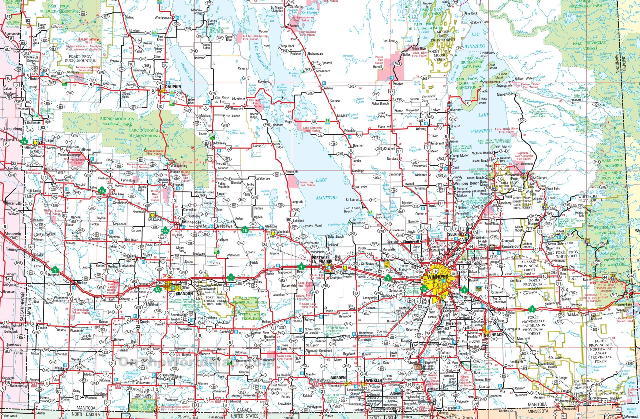
The map of Southern Manitoba is a detailed visual guide showcasing the region at a resolution of 2560×1678 pixels. It likely features the area’s cities, towns, and the network of roads and highways that connect them. The map also includes natural landmarks and provincial parks, such as the Anigotagan Provincial Park, and may highlight First Nations territories like Sagkeeng and Fort Alexander. This map is a valuable tool for anyone exploring the southern part of Manitoba, offering insights into the province’s geography and infrastructure.
Please visit this page for other map resources or Google Maps.
What does this Manitoba map show?
Our map of Southern Manitoba is designed to be comprehensive, showing all major highways, main roads, secondary roads, and essential features of the region, including rivers, lakes, airports, national parks, and provincial parks. The map also includes information on cities and towns in the region, making it easy to plan your route and navigate your way around Southern Manitoba.
What are such maps used for?
Maps like ours are essential for anyone planning a trip to Southern Manitoba. Our map can help you plan your route, identify the highways and roads you must take, and better understand the area’s geography. Whether you’re planning a weekend getaway or a more extended road trip, our map is the perfect tool to help you explore the beauty of Southern Manitoba.
Did you know about Southern Manitoba?
- Southern Manitoba is home to several vibrant cities, including Winnipeg, the province’s capital and largest city, and Brandon, Steinbach, and Morden.
- The region also has several national and provincial parks, including Riding Mountain National Park, Spruce Woods Provincial Park, and Whiteshell Provincial Park.
- Southern Manitoba is known for its stunning natural beauty, wide open prairies, rolling hills, and vast expanses of untouched wilderness.
- The region is also rich in history and culture, with several museums and historic sites, including the Canadian Museum for Human Rights in Winnipeg and the Manitoba Agricultural Museum in Austin.
Conclusion
In conclusion, our map of Southern Manitoba is an essential resource for anyone looking to explore this stunning region of Canada. With its comprehensive coverage of all major highways, main roads, secondary roads, rivers, lakes, airports, national parks, and provincial parks, our map can help you plan your route and discover the unique natural and cultural wonders of Southern Manitoba. Whether you’re a nature lover, a history buff, or an outdoor enthusiast, our map is the perfect tool to help you navigate Southern Manitoba and explore everything this beautiful region offers.