Quebec, a province in eastern Canada, is known for its beautiful landscapes and unique culture. It is the largest province in Canada and the second-most populous province after Ontario. To explore this province, a detailed map is necessary. This post will discuss a map showing Quebec’s cities, towns, highways, main roads, secondary roads, rivers, lakes, railways, airports, national parks, and provincial parks.
Quebec Road Map
This map shows Quebec’s cities, towns, highways, main roads, secondary roads, rivers, lakes, railways, airports, national parks, and provincial parks.
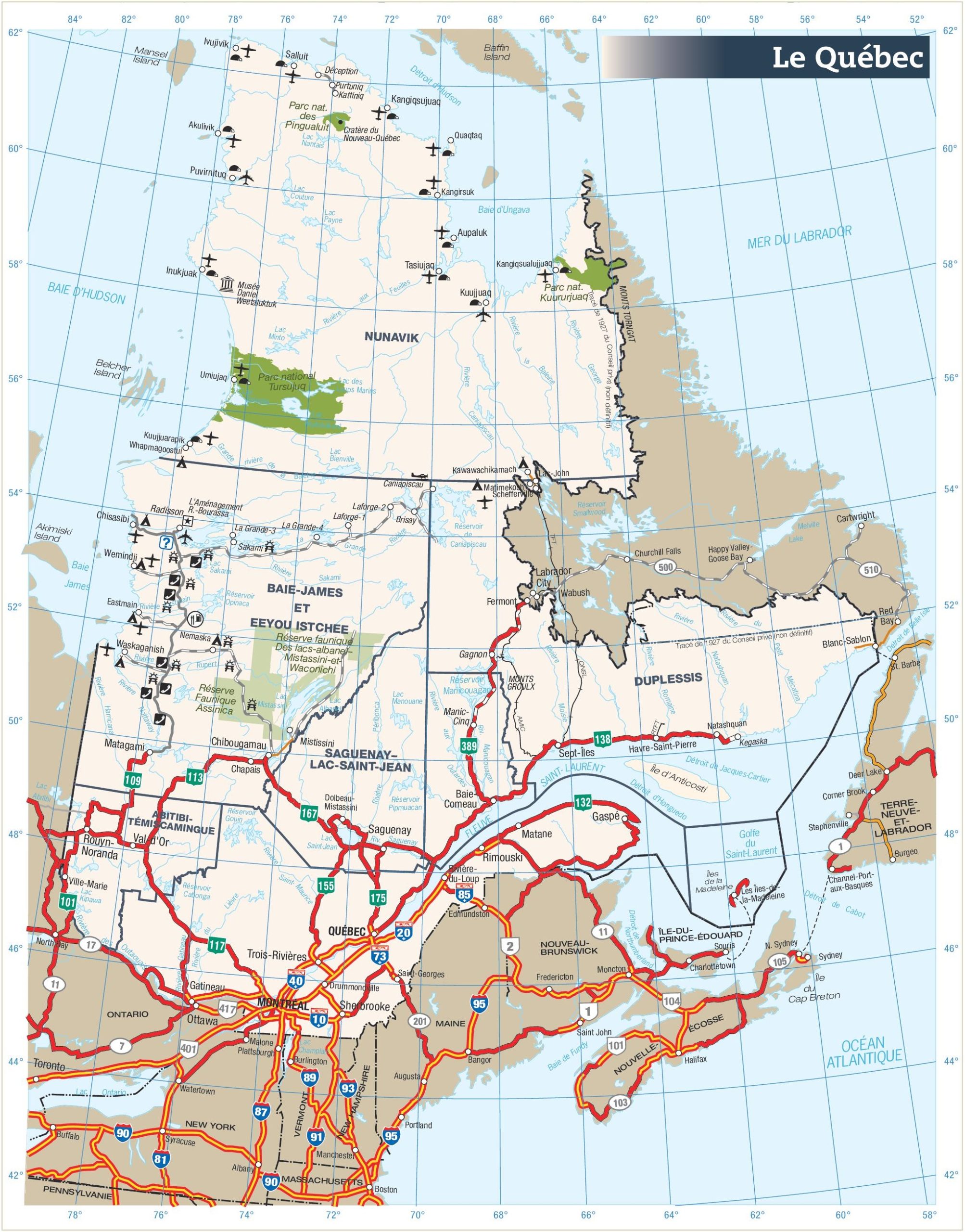
The Quebec road map is a detailed representation of the province’s extensive road network, displayed at a high resolution of 2006×2560 pixels. It includes a comprehensive layout of highways, secondary roads, and notable geographical features such as lakes and rivers. The map also highlights various points of interest, provincial parks, and remote areas, making it a valuable resource for planning road trips and exploring the diverse landscapes of Quebec, from the vibrant cities to the scenic rural regions.
Please visit this page for other map resources or Google Maps.
What are road maps used for?
Maps are used to represent and visualize spatial information. They help us understand and navigate our surroundings, whether exploring new territories or trying to find our way in a familiar place. Maps can be used for various purposes, such as planning a trip, navigating the city, understanding geographic information, and analyzing data.
Did you know about Quebec?
- Quebec is the only province in Canada with French as its official language.
- Quebec is known for its unique culture, including music, art, and cuisine.
- The province has a mix of urban and rural areas, with many small towns and large cities.
- Quebec has several national parks, including Parc National de la Gaspesie and Parc National de la Jacques-Cartier.
Facts about the map
- The map shows all the important features of Quebec, including cities, towns, highways, main roads, secondary roads, rivers, lakes, railways, airports, national parks, and provincial parks.
- The highways and main roads are marked for easy navigation, while the rivers and lakes are detailed for those who want to explore the province’s natural beauty.
- The airports are marked for those who want to fly into Quebec and explore the region by car.
- The national and provincial parks are also marked for those who want to explore the wilderness and enjoy outdoor activities.
Conclusion
In conclusion, this map of Quebec is an essential tool for anyone planning a trip to this beautiful province. It shows all the important features of the region, including cities, towns, highways, main roads, secondary roads, rivers, lakes, railways, airports, national parks, and provincial parks. Whether planning a road trip, exploring the natural beauty of Quebec, or simply navigating through the city, this map is a must-have.