Quebec is a province known for its natural beauty, from stunning rivers and lakes to picturesque towns and cities. If you’re planning a trip to Quebec or want to learn more about this province, our detailed map of Quebec is the perfect resource for you. In this blog post, we’ll explore what this map shows, what such maps are used for, and some interesting facts related to Quebec.
Map of Quebec with Cities and Towns
This map shows cities, towns, rivers, and lakes in Quebec.
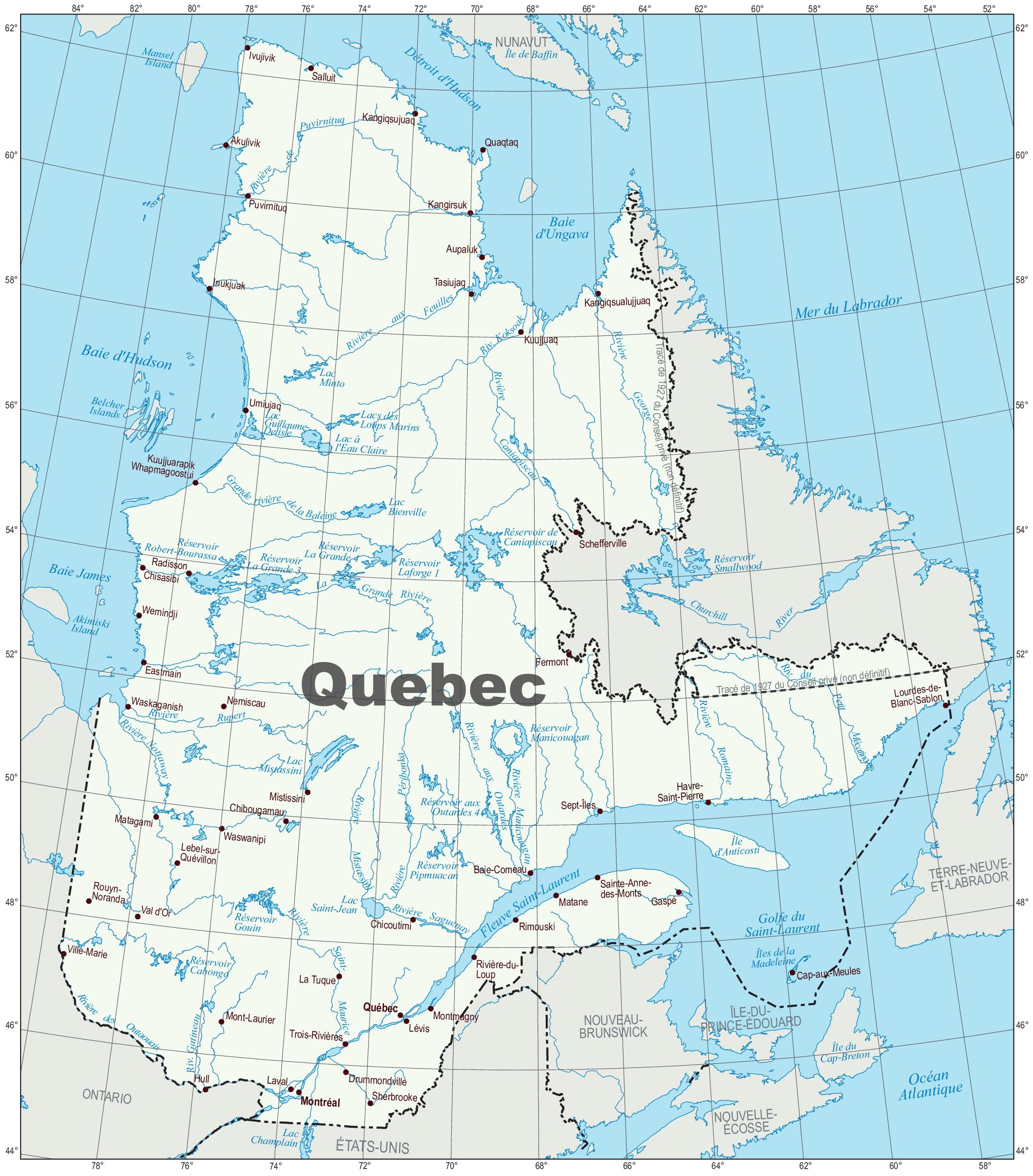
The map of Quebec with cities and towns is a detailed visual representation of the province, rendered at a high resolution of 2211×2517 pixels. It provides a comprehensive view of Quebec’s urban and rural areas, marking the locations of cities, towns, and the network of roads that connect them. The map includes significant geographical features such as the St. Lawrence River, lakes, and the diverse topography that characterizes the province. This map is a valuable tool for anyone looking to explore Quebec, offering insights into the province’s extensive cultural and natural landscapes.
Please visit this page for other map resources or Google Maps.
What does the map of Quebec show?
Our map of Quebec is designed to be comprehensive, showing all major cities, towns, rivers, and lakes in the province. Whether you’re planning a road trip or just want to explore the area, our map can help you plan your itinerary and better understand Quebec’s geography.
What are such Quebec maps used for?
Maps like ours are handy for a variety of purposes. If you’re planning a road trip through Quebec, our map can help you plan your route and identify interesting stops along the way. If you’re interested in fishing or boating, our map can help you locate the best spots to enjoy these activities. And if you’re simply interested in learning more about Quebec, our map can help you better understand the province’s geography and topography.
Did you know about Quebec?
- Quebec is the largest province in Canada by area, covering over 1.5 million square kilometers.
- Quebec City is Quebec’s capital and the only fortified city north of Mexico.
- The St. Lawrence River, which runs through Quebec, is one of the longest rivers in North America and is home to various marine life, including whales and seals.
- Quebec is home to over 30,000 lakes, including the stunning Lake Mistassini, the largest natural lake in Quebec and the largest freshwater lake in the world that is contained entirely within the boundaries of a single province.
Conclusion
In conclusion, our detailed map of Quebec is an essential resource for anyone interested in exploring this beautiful province. Whether you’re planning a trip or just want to learn more about Quebec, our map can help you identify the best spots to visit and better understand the area’s geography and topography. With its comprehensive coverage of cities, towns, rivers, and lakes, our map is the perfect tool for anyone interested in discovering the natural beauty of Quebec.