Quebec is the largest province in Canada, with a unique blend of French and North American cultures. It is home to some of the country’s most vibrant cities, charming towns, stunning national parks, and abundant natural resources. A detailed map is necessary to explore this province’s beauty and diversity. In this blog post, we will discuss a map that shows Quebec’s cities, towns, rivers, lakes, highways, secondary roads, winter roads, railways, and national parks.
Large Detailed Map of Quebec
This map shows Quebec’s cities, towns, rivers, lakes, the Trans-Canada highway, major highways, secondary roads, winter roads, railways, and national parks.
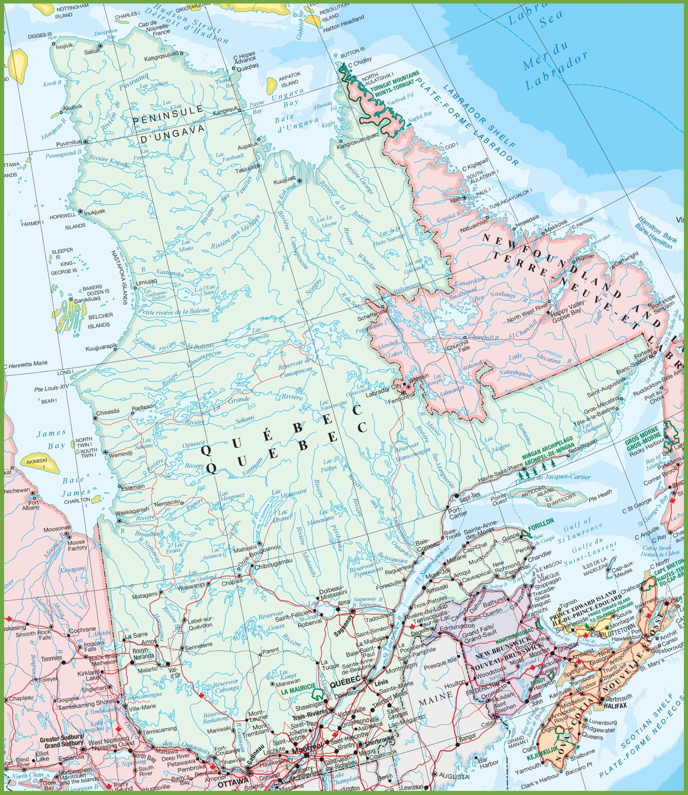
The large detailed map of Quebec is a high-resolution image at 2216×2560 pixels, providing an intricate depiction of the province’s geography. It includes a network of cities, towns, roads, and natural features such as rivers and lakes. This map is particularly useful for those seeking to understand the vast landscape of Quebec, from its urban centers to the remote northern regions, and is an essential tool for travel planning and educational purposes.
Please visit this page for other map resources or Google Maps.
What is the importance of a detailed map of Quebec?
Quebec is a vast province with diverse landscapes, and a detailed map can help visitors plan their trips and explore the region’s unique destinations. The map of Quebec’s cities, towns, rivers, lakes, highways, secondary roads, winter roads, railways, and national parks is valuable for travelers. It can guide visitors to the best locations for sightseeing, outdoor activities, and cultural experiences.
Did you know about Quebec’s National Parks?
Quebec has 27 national parks with unique landscapes, flora, and fauna. For example, Gaspésie National Park features the Chic-Choc Mountains, while Forillon National Park boasts the Percé Rock formation. The map of Quebec’s national parks can help visitors plan their trips and discover the beauty of these protected areas. From hiking and camping to fishing and wildlife viewing, Quebec’s national parks offer something for everyone.
Exploring Quebec’s Winter Roads
Quebec’s winter roads are a unique feature of the province, and the map shows their routes. These roads are only open during the winter when they transport goods and supplies to remote communities. The winter roads allow travelers to experience Quebec’s winter landscape and culture. Snowmobiling and dog sledding are popular activities along these routes, and visitors can also enjoy the northern lights and other winter phenomena.
Conclusion
Quebec is a beautiful and diverse province that offers many unique experiences for travelers. The map of Quebec’s cities, towns, rivers, lakes, highways, secondary roads, winter roads, railways, and national parks is essential for exploring this region’s beauty. Whether you are interested in outdoor activities, cultural experiences, or sightseeing, Quebec has something for everyone. So, grab your map and start planning your adventure in this vibrant province.