Nunavut is Canada’s largest and most sparsely populated territory, covering over 2 million square kilometers in the northernmost part of the country. Despite its remote location, Nunavut is home to several cities and towns, each with its unique culture and history. Our detailed map of Nunavut showcases the territory’s cities, towns, rivers, and lakes, providing a comprehensive view of this stunning region.
Map of Nunavut with Cities and Towns
This map shows Nunavut’s cities, towns, rivers, and lakes.
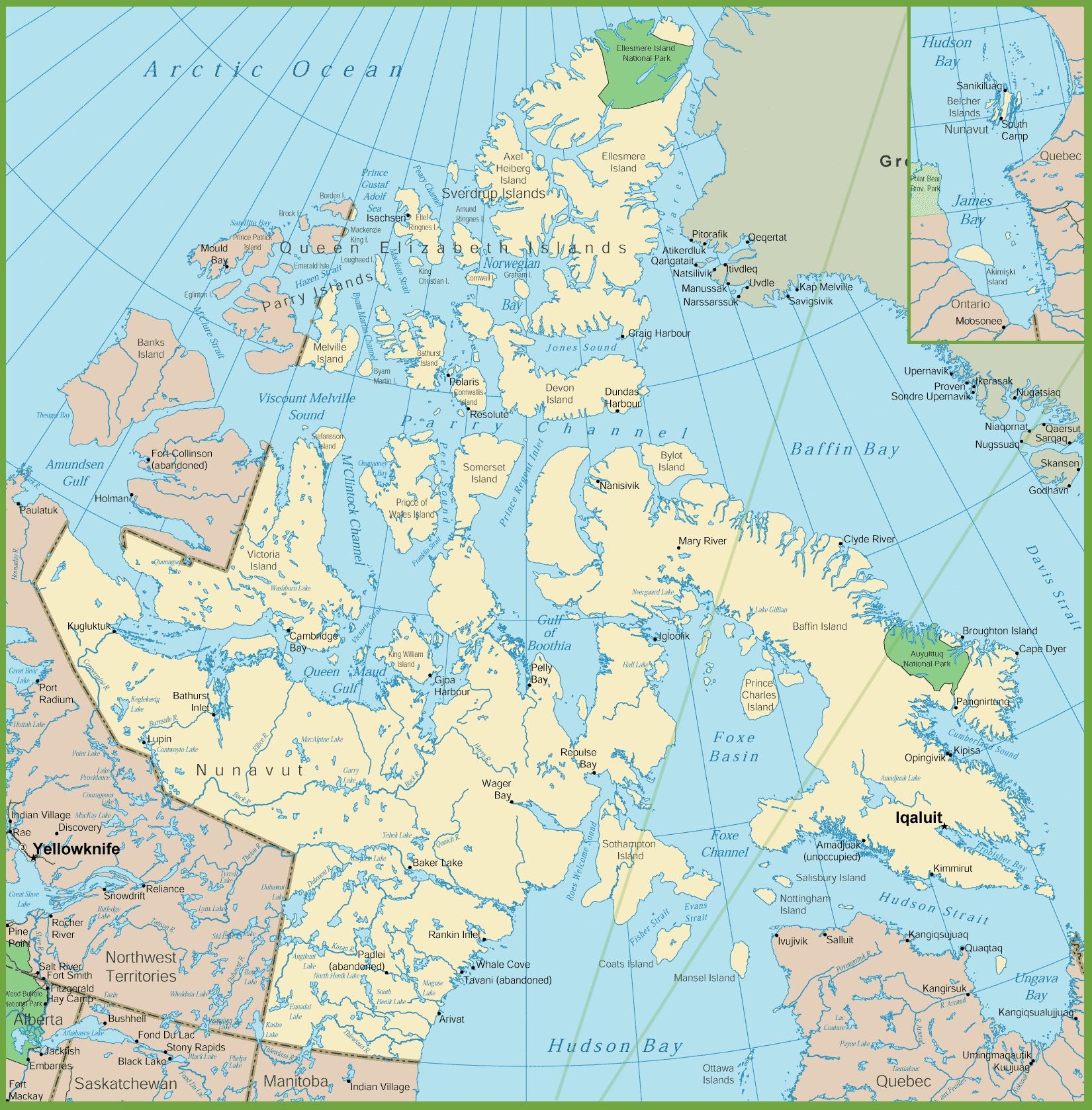
The map of Nunavut with cities and towns is a detailed representation of the territory’s settlements, displayed at a resolution of 1650×1678 pixels. It highlights the sparse and remote communities that are characteristic of this vast Arctic region. The map includes major geographical features such as Amundsen Gulf, Salt River, and the significant presence of Victoria Island. It also shows the expansive Baffin Island, which is home to many of Nunavut’s towns and is a central feature of the territory.
The image mentions places like Resolute and Baker Lake, which are among the many small, isolated communities that rely heavily on air and sea transport for connectivity. The map also gives a sense of the proximity of these communities to significant bodies of water, such as Hudson Bay and the various straits and sounds that define the region’s rugged coastline.
This map is a useful tool for anyone looking to understand the distribution of human settlements within the challenging environment of Nunavut, as well as for those planning travel or logistics in the area.
Please visit this page for other map resources or Google Maps.
What are Such Maps Used for?
Maps are crucial for locals and tourists when exploring a new area. Our detailed map of Nunavut is handy for those interested in learning more about the territory’s cities and towns. The map showcases the locations of Nunavut’s major settlements, including Iqaluit, the capital city, and other communities such as Rankin Inlet, Cambridge Bay, and Pond Inlet. Additionally, the map highlights Nunavut’s rivers and lakes, which are essential to the territory’s transportation and economy.
Did You Know about Nunavut?
Nunavut is a land of extremes, with long, dark winters and short, intense summers. Despite the harsh climate, Nunavut is home to a vibrant and diverse community of people who have adapted to the region’s unique conditions. Nunavut’s Inuit communities have a rich cultural heritage and solid connection to the land and sea. The territory’s cities and towns are the hubs of this culture, offering visitors a glimpse into the traditions and way of life of the people who call Nunavut home.
The territory is also rich in wildlife, including caribou, polar bears, and Arctic foxes. Nunavut’s capital city, Iqaluit, is the largest community in the territory, with just over 7,000 residents. Other notable cities and towns in Nunavut include Arviat, Cambridge Bay, and Rankin Inlet.
Conclusion
Our detailed map is an excellent resource if you’re planning a trip to Nunavut or want to learn more about Canada’s northernmost territory. With its comprehensive view of Nunavut’s cities, towns, rivers, and lakes, our map is the perfect tool for exploring this unique and culturally diverse region.