Nova Scotia is home to some of Canada’s most beautiful national parks, each with unique natural wonders to explore. If you’re planning a trip to Nova Scotia and want to discover the beauty of its national parks, our detailed Nova Scotia national parks map is the perfect resource to guide you. In this blog post, we’ll explore what this map shows, what such maps are used for, and some interesting facts related to Nova Scotia’s national parks.
Nova Scotia National Parks Map
This map shows cities, towns, rivers, lakes, Trans-Canada highways, major highways, secondary roads, winter roads, railways, and national parks in Nova Scotia.
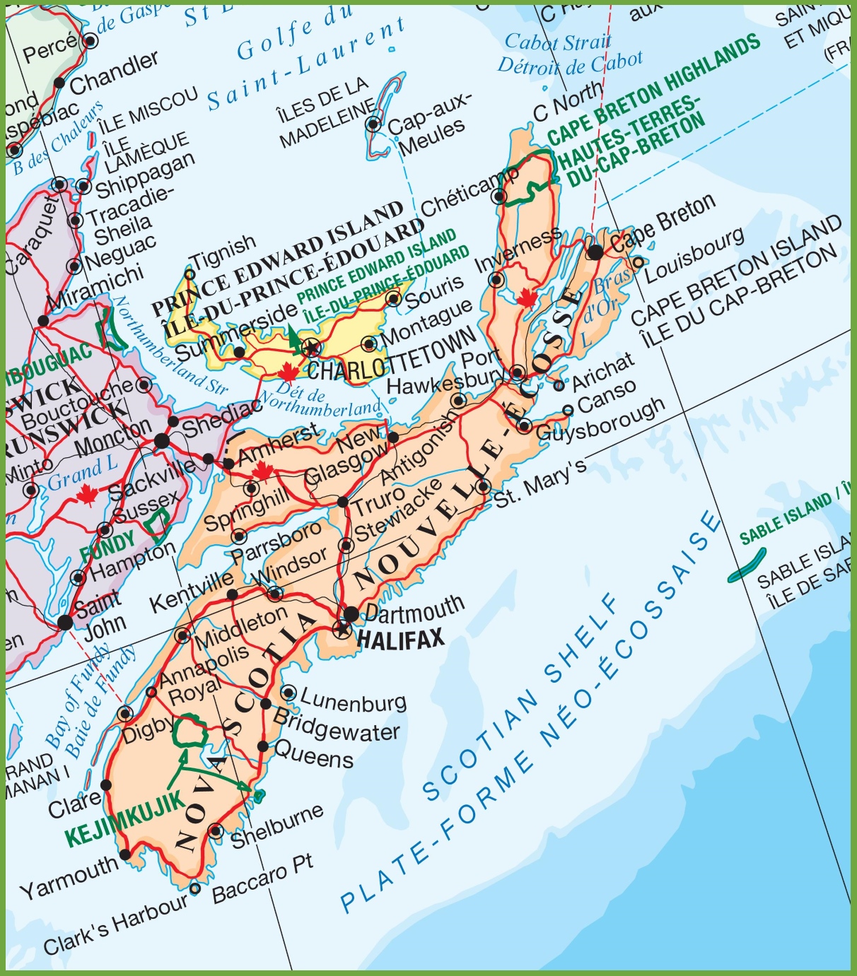
The Nova Scotia national parks map is a focused visual guide detailing the locations of national parks and historic sites within the province. With a resolution of 1212×1381 pixels, it pinpoints parks such as Cape Breton Highlands and Kejimkujik, both renowned for their natural beauty and cultural significance. This map is an essential tool for outdoor enthusiasts and history buffs planning to explore the protected areas of Nova Scotia, offering a snapshot of the province’s commitment to preserving its natural and historical treasures.
Please visit this page for other map resources or Google Maps.
What Does this Nova Scotia National Park Map Show?
Our Nova Scotia national parks map is designed to be comprehensive, showing all national parks in the province, along with their features and locations. The map also includes cities, towns, rivers, lakes, highways, and secondary roads, making it easy to plan your route and find your way to the national parks. You’ll also find information on the Trans-Canada highway, winter roads, and railways to help you plan your journey.
What are such maps used for?
National park maps like ours are essential for anyone planning a trip to explore the natural beauty of Nova Scotia. Our map can help you plan your route, identify the national parks you want to visit, and better understand the area’s geography. Whether you’re an outdoor enthusiast, a nature lover, or simply looking for a peaceful escape from city life, our map is the perfect tool to help you explore Nova Scotia’s national parks.
Did you know about Nova Scotia’s national parks?
- Nova Scotia has five national parks, each with unique features and natural wonders to explore.
- Kejimkujik National Park and National Historic Site is a UNESCO Biosphere Reserve known for its hiking trails, canoe routes, and camping facilities.
- Cape Breton Highlands National Park is known for its stunning coastline, mountains, and the world-famous Cabot Trail, a scenic drive that loops around the northern tip of Cape Breton Island.
- Sable Island National Park Reserve is a unique wilderness area that is only accessible by plane or boat and is home to wild horses and diverse wildlife.
Conclusion
In conclusion, our Nova Scotia National Parks map is an essential resource for anyone planning a trip to explore the province’s natural beauty. With its comprehensive coverage of all national parks and their features and the location of cities, towns, rivers, lakes, highways, and secondary roads, our map can help you plan your route and discover the unique natural wonders of Nova Scotia’s national parks. Whether you’re an outdoor enthusiast or simply looking for a peaceful escape, our map is the perfect tool to help you explore the beauty of Nova Scotia’s natural landscapes.