If you’re planning a road trip through Nova Scotia, you’ll want to have a detailed map of the highways in the area. Our Nova Scotia highway map is designed to help you navigate the province, showing all major highways and their routes. In this blog post, we’ll explore what this map shows, what such maps are used for, and some interesting facts about Nova Scotia.
Nova Scotia Highway Map
This map shows highways in Nova Scotia.
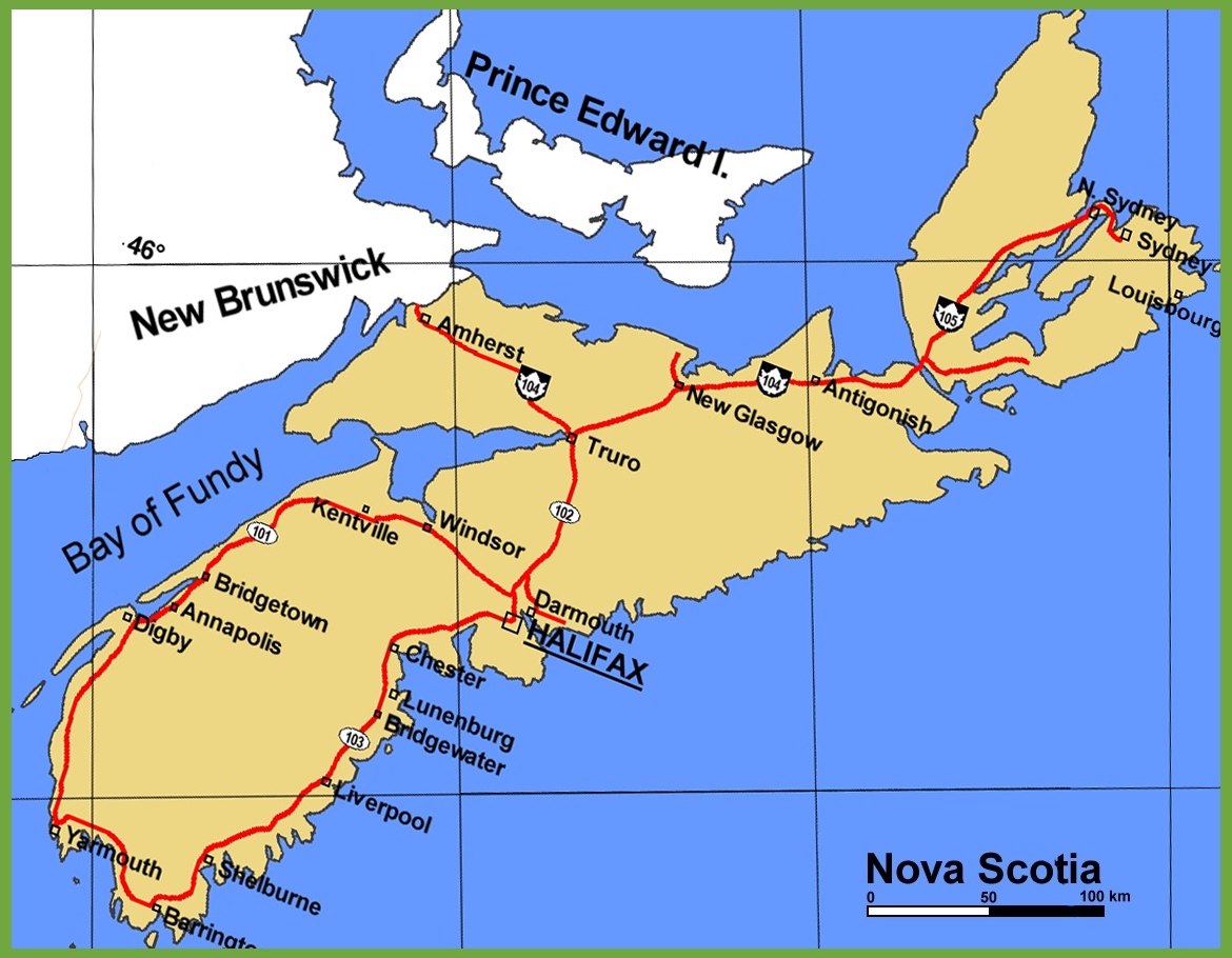
The Nova Scotia highway map is a visual guide to the province’s main transportation routes, presented at a resolution of 1170×910 pixels. It details the network of primary highways, including the famed Cabot Trail and other significant routes that facilitate travel throughout the province. The map is a valuable tool for drivers and travelers, providing a clear view of how to navigate across Nova Scotia, from the bustling capital of Halifax to the picturesque coastal villages and rugged interior landscapes.
Please visit this page for other map resources or Google Maps.
What does this Nova Scotia map show?
Our Nova Scotia highway map is designed to be comprehensive, showing all major highways and their routes in the province. We also highlight the location of rest areas, gas stations, and other amenities along the highways. Whether planning a long road trip from point A to point B, our map can help you plan your route and better understand the significant highways in Nova Scotia.
What are such maps used for?
Highway maps like ours are handy for anyone planning a road trip or looking to navigate their way through a new area. Our map can help you plan your route and exciting stops along the way and better understand the significant highways and their connections in Nova Scotia. Whether you’re a tourist visiting Nova Scotia for the first time or a resident exploring your home province, our highway map is an essential tool for any driver.
Did you know about Nova Scotia?
- Nova Scotia is home to the world-famous Cabot Trail, a scenic drive that loops around the northern tip of Cape Breton Island and is considered one of the most beautiful drives in the world.
- The province is known for its stunning coastline, with over 13,000 kilometers of shoreline.
- Nova Scotia is home to several historic sites, including the Fortress of Louisbourg, a French fort built in the early 18th century and now a national historic site.
- The Halifax Citadel, a historic fort in downtown Halifax, is one of the most popular tourist destinations in Nova Scotia.
Conclusion
In conclusion, our Nova Scotia highway map is an essential resource for anyone planning a road trip or navigating the province. With its comprehensive coverage of all major highways and their routes, as well as the location of rest areas and other amenities, our map can help you plan your exciting stops along the way and better understand the major highways in Nova Scotia. Whether you’re a tourist or a local resident, our highway map is the perfect tool for exploring the beauty of Nova Scotia by car.