Map Resources

Home » Map Resources » Page 9

Exploring Pacific Standard Time (PST) in Canada: A Guide for Travelers and Locals Alike

Pacific Standard Time Zone Map

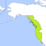
Pacific Standard Time (PST) is a time zone used in the western part of North America, including the western provinces of Canada and some U.S. states. It is eight hours behind Coordinated Universal Time (UTC-8) and three hours behind Eastern Standard Time (EST). PST is used to standardize time within a given region and is regulated by the federal government in Canada. Travelers and tourists need to understand PST, as it can affect flight schedules, hotel check-in times, and other aspects of travel planning.

Home » Map Resources » Page 9

Nova Scotia without names map – Explore Canada with ease using our printable maps!

Nova Scotia without names map

The outline map of Ontario depicts the province’s boundary, coastline, and major water systems, offering a simplified and clear view of the region’s significant features. By excluding the names of major political and geographical features, the map emphasizes the importance of Ontario’s essential water bodies, which have played a crucial role in the province’s history and development. The map can be helpful for various purposes, including educational, environmental, and recreational pursuits.

Home » Map Resources » Page 9

Ontario without the names map – Explore Canada with ease using our printable maps!

Ontario without the names map

The outline map of Ontario without the names of major political and geographical features offers a simplified yet informative view of the province’s essential water systems, emphasizing their critical role in the region’s history, ecology, and economy. The map can be used by a wide range of individuals and organizations for educational, environmental, and recreational purposes, offering a valuable tool for exploring, studying, and appreciating the natural beauty of this essential Canadian province.

Home » Map Resources » Page 9

Newfoundland and Labrador without the names map – Explore Canada with ease using our printable maps!

Newfoundland and Labrador without the names map

The outline map of Newfoundland and Labrador without the names of major political and geographical features is a simplified yet informative representation of the region’s geography. The map highlights Newfoundland and Labrador’s boundary, coastline, and major water systems, including its lakes and rivers. The map can be used for various purposes, including education, research, and recreational activities. It is a valuable tool for exploring, studying, and appreciating the natural beauty of Newfoundland and Labrador’s water resources.

Home » Map Resources » Page 9

Prince Edward Island without names map – Explore Canada with ease using our printable maps!

Prince Edward Island without names map

The black-and-white outline map of Prince Edward Island is a versatile tool that can be used for educational, environmental, recreational, and business purposes. It highlights the province’s essential water systems and omits the names of major political and geographical features.

Home » Map Resources » Page 9

Saskatchewan without names map – Explore Canada with ease using our printable maps!

Saskatchewan without the names map

This relief map of Yukon provides a visual representation of the region’s topography using hypsometric tints and spot elevations. The map also depicts significant lakes in the region, which helps users navigate the landscape. The legend provides viewers with important information on the elevation ranges represented by the different colors.

Home » Map Resources » Page 9

Quebec without Names Map – Explore Canada with ease using our printable maps!

Quebec without names map

The black-and-white outline map of Quebec highlights the province’s boundary, coastline, and major water systems. It offers a clear visual representation of the province’s most significant water features, allowing viewers to appreciate the natural beauty of its landscape. The map can be helpful for schools and universities to help students learn about Quebec’s geography and water systems. Tourists can also use the map to explore the province’s lakes and rivers, plan their trips, and engage in outdoor activities. In addition, businesses can use the map to understand the province’s waterways, plan transportation routes, or identify opportunities for outdoor recreational activities.

Home » Map Resources » Page 9

New Brunswick Relief Map – Explore Canada with ease using our printable maps!

New Brunswick Relief Map

The post offers a high-quality relief map of New Brunswick that uses hypsometric tints and spot elevations to display the province’s elevation data. The map is based on reliable and up-to-date data, and it can be used for a variety of purposes, including outdoor recreation, planning, research, and resource management.