Home »

Quebec without Names Map – Explore Canada with ease using our printable maps!
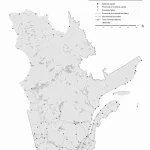
The black-and-white outline map of Quebec highlights the province’s boundary, coastline, and major water systems. It offers a clear visual representation of the province’s most significant water features, allowing viewers to appreciate the natural beauty of its landscape. The map can be helpful for schools and universities to help students learn about Quebec’s geography and water systems. Tourists can also use the map to explore the province’s lakes and rivers, plan their trips, and engage in outdoor activities. In addition, businesses can use the map to understand the province’s waterways, plan transportation routes, or identify opportunities for outdoor recreational activities.