Welcome to CanadaMaps.com, where we provide comprehensive maps of Canada to help you explore and navigate the country. Our maps showcase the beauty and diversity of Canada, from its vast wilderness to its bustling cities. This blog post will focus on the Alberta province and its stunning natural landscapes.
Alberta Road Map
This map shows Alberta’s cities, towns, highways, main roads, secondary roads, rivers, lakes, national parks, and provincial parks.
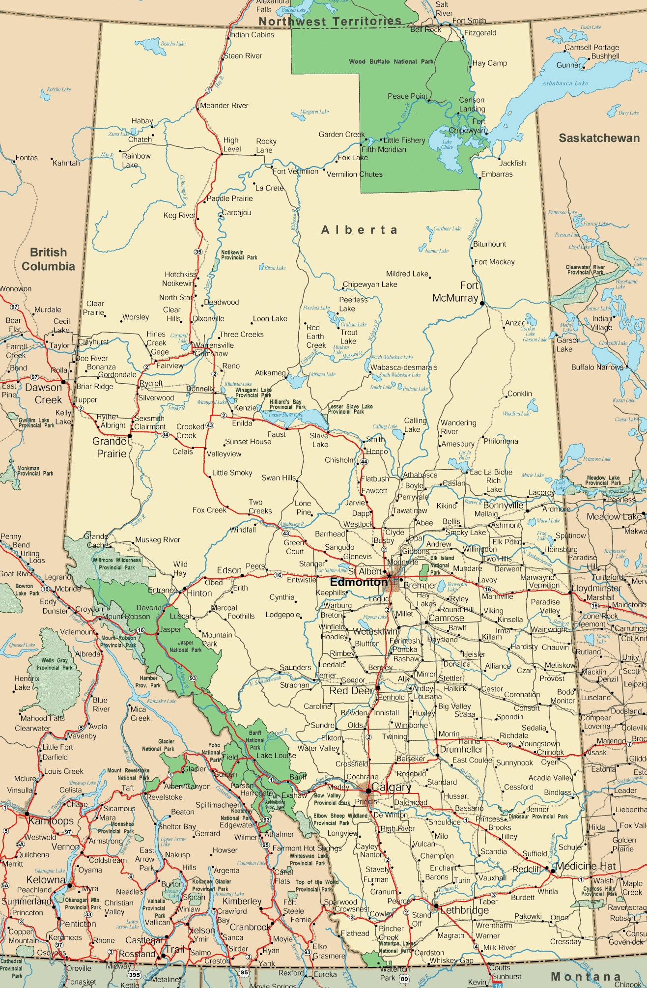
This Alberta road map is a comprehensive navigation tool detailing the province’s extensive road network. With a resolution of 1317×2011 pixels, it provides a clear depiction of major highways, secondary roads, and important landmarks. It’s an invaluable resource for travelers and locals alike, offering insights into the connectivity of urban and rural areas across Alberta.
Please visit this page for other map resources or Google Maps.
What Are Such Maps Used For?
Maps are essential for exploring new territories and providing valuable information about the land’s geography, topography, and features. A map of Alberta is no exception, allowing visitors to navigate the province efficiently and plan their trips accordingly. This map provides valuable information about the major cities, towns, highways, main roads, secondary roads, rivers, lakes, national parks, and provincial parks in Alberta, making it an indispensable resource for anyone exploring the province.
Did You Know About Canada?
Canada is known for its vast wilderness, diverse wildlife, and friendly people. Alberta, located in western Canada, is one of the country’s ten provinces and is home to some of Canada’s most iconic natural attractions. The province is known for its stunning mountain ranges, pristine lakes and rivers, and world-renowned national parks.
The map of Alberta showcases the province’s natural beauty, highlighting the major rivers that flow through the province, including the Athabasca River, the Bow River, and the North Saskatchewan River. These rivers provide essential water resources and recreational opportunities such as fishing, rafting, and kayaking.
The map also shows Alberta’s national and provincial parks, including Banff National Park, Jasper National Park, and Kananaskis Country. These parks are renowned for their breathtaking scenery, wildlife, and outdoor activities like hiking, skiing, and camping.
Conclusion
In conclusion, a map of Alberta is an essential tool for anyone exploring the province. It provides valuable information about the major cities, towns, highways, main roads, secondary roads, rivers, lakes, national parks, and provincial parks, allowing visitors to plan their trips efficiently. Additionally, it showcases the province’s beauty and diversity, highlighting Alberta’s natural wonders, some of Canada’s most iconic attractions.