map

Home » map » Page 7

Ontario without the names map – Explore Canada with ease using our printable maps!

Ontario without the names map

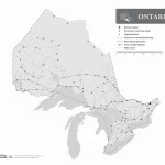
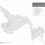
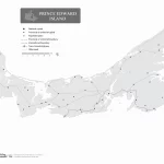
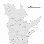
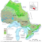
The outline map of Ontario without the names of major political and geographical features offers a simplified yet informative view of the province’s essential water systems, emphasizing their critical role in the region’s history, ecology, and economy. The map can be used by a wide range of individuals and organizations for educational, environmental, and recreational purposes, offering a valuable tool for exploring, studying, and appreciating the natural beauty of this essential Canadian province.

Home » map » Page 7

Newfoundland and Labrador without the names map – Explore Canada with ease using our printable maps!

Newfoundland and Labrador without the names map

The outline map of Newfoundland and Labrador without the names of major political and geographical features is a simplified yet informative representation of the region’s geography. The map highlights Newfoundland and Labrador’s boundary, coastline, and major water systems, including its lakes and rivers. The map can be used for various purposes, including education, research, and recreational activities. It is a valuable tool for exploring, studying, and appreciating the natural beauty of Newfoundland and Labrador’s water resources.

Home » map » Page 7

Prince Edward Island without names map – Explore Canada with ease using our printable maps!

Prince Edward Island without names map

The black-and-white outline map of Prince Edward Island is a versatile tool that can be used for educational, environmental, recreational, and business purposes. It highlights the province’s essential water systems and omits the names of major political and geographical features.

Home » map » Page 7

Saskatchewan without names map – Explore Canada with ease using our printable maps!

Saskatchewan without the names map

This relief map of Yukon provides a visual representation of the region’s topography using hypsometric tints and spot elevations. The map also depicts significant lakes in the region, which helps users navigate the landscape. The legend provides viewers with important information on the elevation ranges represented by the different colors.

Home » map » Page 7

Quebec without Names Map – Explore Canada with ease using our printable maps!

Quebec without names map

The black-and-white outline map of Quebec highlights the province’s boundary, coastline, and major water systems. It offers a clear visual representation of the province’s most significant water features, allowing viewers to appreciate the natural beauty of its landscape. The map can be helpful for schools and universities to help students learn about Quebec’s geography and water systems. Tourists can also use the map to explore the province’s lakes and rivers, plan their trips, and engage in outdoor activities. In addition, businesses can use the map to understand the province’s waterways, plan transportation routes, or identify opportunities for outdoor recreational activities.

Home » map » Page 7

Nunavut Relief Map – Explore Canada with ease using our printable maps!

Nunavut Relief Map

The relief map of Nunavut is a powerful tool that can be used for many different purposes, from natural resource management to scientific research and emergency management. Its use of hypsometric tints and spot elevations makes it an essential tool for understanding the complex and diverse landscape of this vast and unique Canadian territory.

Home » map » Page 7

Ontario Relief Map – Explore Canada with ease using our printable maps!

Ontario Relief Map

This relief map of Yukon shows the territory’s diverse topography using hypsometric tints and spot elevations. It also highlights significant regional lakes, which helps users navigate the map more easily. The map legend provides viewers with important information on the different elevation ranges represented by the various colors.

Home » map » Page 7

Prince Edward Island Relief Map – Explore Canada easily using our printable maps!

Prince Edward Island Relief Map

This relief map of Prince Edward Island provides a clear and accurate representation of the terrain, using hypsometric tints and spot elevations to represent different elevations. In addition to elevation data, the map also highlights the location of major lakes on the island, which play a crucial role in the island’s ecology, culture, and economy. The elevation ranges provided in the map legend are an essential feature of the map, providing viewers with a clear understanding of the different elevations represented by the various colors. This information is valuable for various applications, such as land use planning, geological studies, and environmental management.

Home » map » Page 7

Quebec Relief Map – Explore Canada with ease using our printable maps!

Quebec Relief Map

This relief map of Yukon, a territory located in northwest Canada, provides a visual representation of the region’s diverse topography. It uses hypsometric tints and spot elevations to indicate different elevations, as well as show major lakes in the area. The map legend provides users with important information on the elevation ranges, helping them understand the different terrain types they may encounter during their travels.

Home » map » Page 7

Saskatchewan Relief Map – Explore Canada with ease using our printable maps!

Saskatchewan Relief Map

This relief map of Yukon uses hypsometric tints and spot elevations to show the varying elevations of different areas of the territory. The map also includes a legend with information on the elevation ranges represented by the different colors.