British Columbia is a vast province located on the west coast of Canada. With its towering mountains, stunning lakes, and rugged coastline, it’s no wonder that British Columbia is a popular destination for tourists worldwide. Whether you’re planning a road trip or hiking adventure or want to explore this province’s many charming towns and cities, a good map is essential. In this blog post, we’ll take a closer look at a map that shows the highways, main roads, secondary roads, rivers, lakes, national parks, and provincial parks in British Columbia.
British Columbia Road Map
This map shows cities, towns, highways, main roads, secondary roads, rivers, lakes, national parks, and provincial parks in British Columbia.
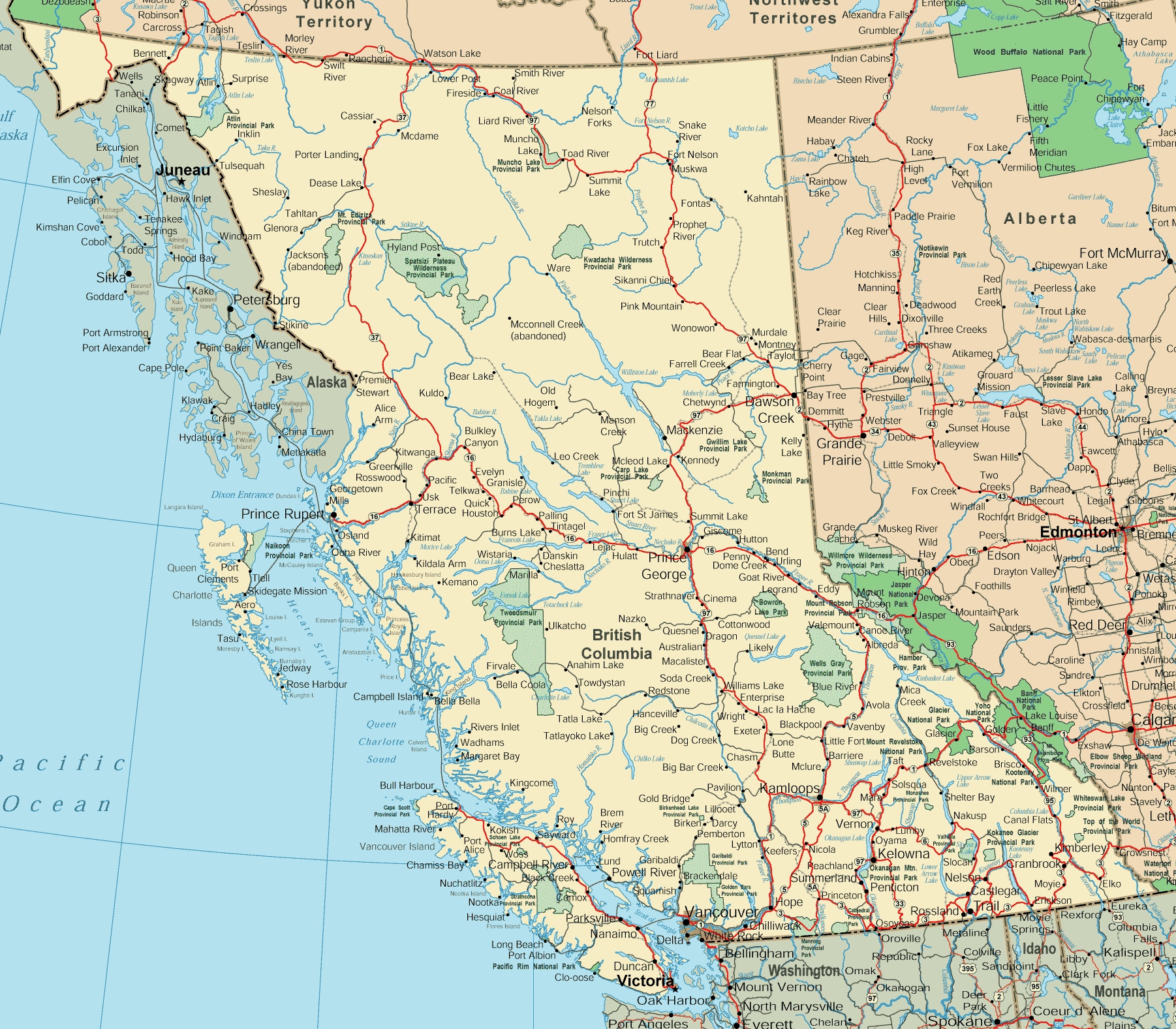
This road map of British Columbia is a detailed navigation tool displayed at a resolution of 1802×1577 pixels. It outlines the province’s extensive road system, including highways, secondary roads, and notable geographical features such as lakes and rivers. The map also highlights various points of interest, provincial parks, and remote areas, making it a valuable resource for planning road trips and exploring the diverse landscapes of British Columbia, from the coastal regions to the interior and northern territories.
Please visit this page for other map resources or for Google Maps.
The Importance of Maps
When Exploring British Columbia: British Columbia is a large province, and navigating without a good map can be overwhelming. Whether you’re driving on the highways or exploring the back roads, a map will help you stay on track and ensure that you don’t miss any of the stunning scenery or attractions along the way. A detailed map can also help you plan your route, find accommodations, and locate services like gas stations and rest areas.
Did You Know?
Fun Facts about British Columbia:
- British Columbia is the westernmost province in Canada, home to over 5 million people.
- The province is known for its incredible natural beauty, including the Rocky Mountains, the Pacific Ocean, and countless lakes and rivers.
- British Columbia is home to more than 1,000 provincial parks and protected areas, making it a paradise for outdoor enthusiasts.
- The province is also known for its vibrant cities, including Vancouver, Victoria, and Kelowna, which offer a wide range of cultural attractions and activities.
Discover the Wonders of British Columbia with this Map
This comprehensive map of British Columbia shows all the major highways, main roads, and secondary roads in the province, as well as rivers, lakes, national parks, and provincial parks. Whether you’re planning a road trip, a camping adventure, or a day trip to explore a new city, this map will help you easily navigate the province. You can use the map to plan your route, find attractions, and locate services like gas stations, rest areas, and accommodations.
Conclusion
A good map is essential if you’re planning a trip to British Columbia. This map of highways, main roads, secondary roads, rivers, lakes, national parks, and provincial parks will help you navigate your way through the province and ensure that you don’t miss any of the incredible scenery and attractions that British Columbia has to offer. With this map in hand, you can confidently explore the province and make memories that will last a lifetime.