Home »

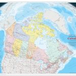
Large, printable, detailed relief map of Canada with cities and towns
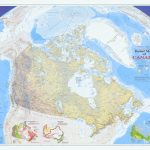
This post offers a detailed map of Canada that features the Vertical Near-Side Perspective Projection. This projection provides a view of Canada that highlights the country’s natural features with very-detailed digital shaded relief. The map is a comprehensive resource for anyone interested in exploring Canada’s vast geography, including all official Canadian, provincial, and surrounding international boundaries.