Home »

Nova Scotia Relief Map – Explore Canada with ease using our printable maps!
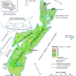
The relief map of Nova Scotia provides detailed topographical information on the region, including elevation data and major lakes. The map uses hypsometric tints and spot elevations to represent different elevations, making it a valuable tool for various applications, such as natural resource management, scientific research, emergency management, and tourism.