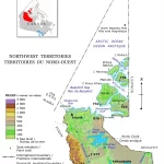
Northwest Territories Relief Map – Explore Canada with ease using our printable maps!
The relief map of Northwest Territories on our website is an essential tool for understanding the region’s topography. It includes hypsometric tints that indicate elevation, spot elevations, major lakes, and other features. The map legend provides information on elevation ranges.
