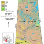
Home » Saskatchewan »

Discover Canada’s Landscapes and Transportation Networks with Canada Maps
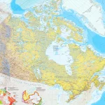
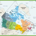
This map shows Canada’s provinces, territories, provincial and territorial capitals, cities, towns, highways, roads, trans-Canada highways, railways, and rivers.